Villa Bedretto
| Bedretto | ||
|---|---|---|
 |
||
|
||
| Coordinates: 46°30′N 8°31′E / 46.500°N 8.517°ECoordinates: 46°30′N 8°31′E / 46.500°N 8.517°E | ||
| Country | Switzerland | |
| Canton | Ticino | |
| District | Leventina | |
| Government | ||
| • Mayor | Sindaco | |
| Area | ||
| • Total | 75.23 km2 (29.05 sq mi) | |
| Elevation | 1,402 m (4,600 ft) | |
| Population (Dec 2016) | ||
| • Total | 109 | |
| • Density | 1.4/km2 (3.8/sq mi) | |
| Postal code | 6781 | |
| SFOS number | 5063 | |
| Surrounded by | Airolo, Cevio, Formazza (IT-VB), Lavizzara, Oberwald (VS), Realp (UR), Ulrichen (VS) | |
| Website |
http://www.bedretto.ch SFSO statistics |
|
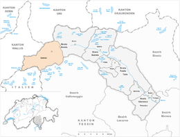
Bedretto is a municipality in the district of Leventina in the canton of Ticino in Switzerland.
In 1906 pre-Roman graves and a Roman era villa and coins were discovered in Bedretto. The presumption, that it was originally part of Airolo, could not be confirmed by any available records. Bedretto is first mentioned in 1210 as Bedoledo and at that time it was a separate municipality. Already in 1227, when the alpine pastures of Leventina valley were divided among the communities, Bedretto had dependent, surrounding farms and hamlets. Bedretto was the only community that was not given any alpine pastures.
In 1227, Bedretto is also mentioned as a separate parish. The parish churchof SS Martiri Maccabei in the settlement of Villa was rebuilt after its destruction by an avalanche in 1594. The existing building dates from the 19th Century.
The hospice in All'Acqua was the starting point to two famous mountain crossings: the Nufenen Pass, which leads to Ulrichen in the Upper Valais, and the Passo di San Giacomo, which leads to the Italian Formazza valley. The Hospice of Valdolgia or St. Nicholas on the Passo di San Giacomo was a second station in the old mule track. Due to the steep slopes of Bedretto Valley, avalanches often hit the villages. The avalanche in 1863, destroyed half the village and killed 29 people, and the one in 1749 killed 13. In winter, the valley is often cut off and the connection of villages to each other and with Airolo may be interrupted for days. With the construction of avalanche barriers, the situation has improved. The road between Airolo and Bedrett opened in 1924, was extended in 1932 to Ronco then in 1964 extended beyond Nufenen. The valley is also today still fairly isolated and without a constant connection with Valais, since a rail project to connect the valley to the Furka Oberalp Bahn as part of the Furka Base Tunnel project failed. Historically, the scarce resources of the valley (cattle, dairy farming and cultivation of potatoes and rye) were insufficient to feed all of the inhabitants. So they were forced to seasonal migrate abroad (mainly in Italy and France) seeking work as chestnut roasters, waitresses or domestic servants. Since the seasonal migration ceased at the end of World War II, the valley has depopulated more rapidly. The decline of the permanent resident population is offset in the summer months by the return of locals and offset in the winter by the influx of tourists and holiday guests.
...
Wikipedia


