Vila Velha de Ródão
| Vila Velha de Rodão | |||
|---|---|---|---|
| Municipality | |||
|
|||
 |
|||
| Coordinates: 39°39′15″N 7°40′20″W / 39.65417°N 7.67222°WCoordinates: 39°39′15″N 7°40′20″W / 39.65417°N 7.67222°W | |||
| Country |
|
||
| Region | Centro | ||
| Subregion | Beira Interior Sul | ||
| Intermunic. comm. | Beira Baixa | ||
| District | Castelo Branco | ||
| Parishes | 4 | ||
| Government | |||
| • President | Maria Carmo Sequeira (PS) | ||
| Area | |||
| • Total | 329.91 km2 (127.38 sq mi) | ||
| Population (2011) | |||
| • Total | 3,521 | ||
| • Density | 11/km2 (28/sq mi) | ||
| Time zone | WET/WEST (UTC+0/+1) | ||
| Website | http://www.cm-vvrodao.pt/ | ||
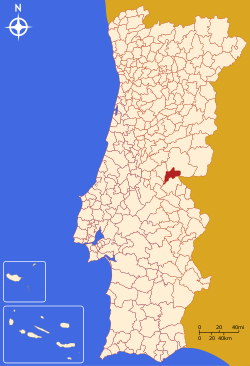
Vila Velha de Ródão (Portuguese pronunciation: [ˈvilɐ ˈvɛʎɐ ðɨ ˈʁɔðɐ̃w̃]) is a municipality in the district of Castelo Branco in Portugal. The population in 2011 was 3,521, in an area of 329.91 km².
The present mayor is Maria Carmo Sequeira, elected by the Socialist Party. The municipal holiday is the Monday after the 4th Sunday of August.
In 1762 it was the site of the Battle of Vila Velha.
On 5 November 2007, a road accident on A23 killed 15 people and injured 22.
Administratively, the municipality is divided into 4 civil parishes (freguesias):
...
Wikipedia


