Vestavia Hills
| Vestavia Hills, Alabama | |
|---|---|
| City | |

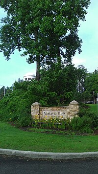
Entrance to Vestavia Hills from Highway 31
|
|
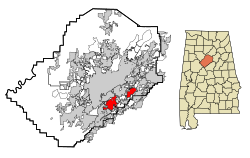
 Location in Jefferson County and the state of Alabama |
|
| Coordinates: 33°25′59″N 86°46′44″W / 33.43306°N 86.77889°W | |
| Country | United States |
| State | Alabama |
| Counties | Jefferson, Shelby |
| Government | |
| • Type | Mayor-council |
| • Mayor | Ashley Curry |
| Area | |
| • Total | 19.41 sq mi (37.9 km2) |
| • Land | 14.6 sq mi (37.9 km2) |
| • Water | 0.01 sq mi (0.03 km2) |
| Elevation | 951 ft (290 m) |
| Population (2013) | |
| • Total | 34,018 |
| • Density | 2,331/sq mi (897.9/km2) |
| Time zone | Central (CST) (UTC-6) |
| • Summer (DST) | CDT (UTC-5) |
| ZIP codes | 35216, 35226, 35243, 35242 |
| Area code(s) | 205 |
| FIPS code | 01-78552 |
| GNIS feature ID | 0153841 |
| Website | http://vhal.org/ |
Vestavia Hills is a city in Jefferson and Shelby counties in the State of Alabama. It is an affluent suburb of the city of Birmingham. As of the 2010 census, its population was 34,033, up from 24,476 in 2000. It moved up from the fifth largest city in Jefferson County in 2000 to the third largest in 2010, behind Birmingham and Hoover.
Vestavia Hills is named for the 20-acre (8.1 ha) estate of former Birmingham mayor George B. Ward. It was situated on the crest of Shades Mountain in what is now the northern edge of the city. Ward's mansion at the Vestavia estate became a landmark in the area as soon as it was completed in 1925. The 2 1⁄2-story house was patterned after the circular Temple of Vesta in Rome, with dark pink sandstone walls encircled by twenty massive white Doric columns surmounted by a carved entablature. The extensive gardens, populated by statuary and peacocks, surrounded a smaller domed gazebo patterned after the Temple of Sibyl in Tivoli.
After Ward's death, the house, something of a tourist stop near the highway between Birmingham and Montgomery, was used as a tearoom and reception hall before being purchased by Vestavia Hills Baptist Church. The church met in the temple like structure for several years before demolishing a portion of the building in 1971 to make way for a larger building; a central portion of the original building remains. The local garden club moved the gazebo to a prominent outcropping closer to the highway, there to serve as a landmark gateway into the community.
...
Wikipedia
