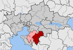
Vasilika, Thessaloniki
|
Vasilika Βασιλικά |
|
|---|---|
| Coordinates: 40°28.8′N 23°8.2′E / 40.4800°N 23.1367°ECoordinates: 40°28.8′N 23°8.2′E / 40.4800°N 23.1367°E | |
| Country | Greece |
| Administrative region | Central Macedonia |
| Regional unit | Thessaloniki |
| Municipality | Thermi |
| • Municipal unit | 200.336 km2 (77.350 sq mi) |
| Elevation | 75 m (246 ft) |
| Population (2011) | |
| • Rural | 3,762 |
| • Municipal unit | 9,911 |
| • Municipal unit density | 49/km2 (130/sq mi) |
| Community | |
| • Population | 4,200 (2011) |
| • Area (km2) | 56.81 |
| Time zone | EET (UTC+2) |
| • Summer (DST) | EEST (UTC+3) |
| Postal code | 570 06 |
| Area code(s) | +30-2396-xxx-xxx |
| Vehicle registration | NAx-xxxx to NXx-xxxx |
Vasilika (Greek: Βασιλικά) is a community and a municipal unit of the Thermi municipality. Before the 2011 local government reform the municipal unit of Vasilika was an independent municipality, with the respective community being the seat. The 2011 census recorded 4,200 inhabitants in the community and 9,911 inhabitants in the municipal unit. The community of Vasilika covers an area of 56.81 km2 while the respective municipal unit covers an area of 200.336 km2.
The community of Vasilika consists of two separate settlements:
The aforementioned population figures are as of 2011.
...
Wikipedia


