Valley Hi, Ohio
| Valley Hi, Ohio | |
|---|---|
| Village | |

Mad River Mountain, with subdivisions in the hills above
|
|
 Location of Valley Hi, Ohio |
|
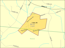
 Detailed map of Valley Hi |
|
| Coordinates: 40°18′45″N 83°40′46″W / 40.31250°N 83.67944°WCoordinates: 40°18′45″N 83°40′46″W / 40.31250°N 83.67944°W | |
| Country | United States |
| State | Ohio |
| County | Logan |
| Area | |
| • Total | 0.62 sq mi (1.61 km2) |
| • Land | 0.62 sq mi (1.61 km2) |
| • Water | 0 sq mi (0 km2) |
| Elevation | 1,270 ft (387 m) |
| Population (2010) | |
| • Total | 212 |
| • Estimate (2012) | 211 |
| • Density | 341.9/sq mi (132.0/km2) |
| Time zone | Eastern (EST) (UTC-5) |
| • Summer (DST) | EDT (UTC-4) |
| FIPS code | 39-79226 |
| GNIS feature ID | 1055101 |
Valley Hi is a village in Logan County, Ohio, United States. The population was 212 at the 2010 census. The village is located nearby U.S. Route 33 and is about an hour northwest of Columbus. The village lies mostly in Jefferson Township, but its southernmost portion extends into Monroe Township.
The village is located in an area with some of the steepest terrain in normally flat Western Ohio and serves as home to the Mad River Mountain ski area. In fact, most of the village is located on top of a steep ridge (mountain, by some standards) and is actually located above the ski area, with many of the slopes circling one side of the village. Valley Hi has a distinct "Alpine" flavor with many of the streets named for European mountain locations and homes decorated in a Swiss chalet style.
Valley Hi is located at 40°18′45″N 83°40′46″W / 40.31250°N 83.67944°W (40.312531, -83.679559).
According to the United States Census Bureau, the village has a total area of 0.62 square miles (1.61 km2), all of it land.
As of the census of 2010, there were 212 people, 87 households, and 53 families residing in the village. The population density was 341.9 inhabitants per square mile (132.0/km2). There were 165 housing units at an average density of 266.1 per square mile (102.7/km2). The racial makeup of the village was 95.8% White, 1.4% African American, 0.9% Native American, 0.5% from other races, and 1.4% from two or more races. Hispanic or Latino of any race were 3.3% of the population.
...
Wikipedia
