Valley Falls, Kansas
| Valley Falls, Kansas | |
|---|---|
| City | |

Business district of Valley Falls (2014)
|
|
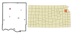
 Location within Jefferson County and Kansas |
|
 KDOT map of Jefferson County (legend) |
|
| Coordinates: 39°20′35″N 95°27′38″W / 39.34306°N 95.46056°WCoordinates: 39°20′35″N 95°27′38″W / 39.34306°N 95.46056°W | |
| Country | United States |
| State | Kansas |
| County | Jefferson |
| Area | |
| • Total | 0.78 sq mi (2.02 km2) |
| • Land | 0.77 sq mi (1.99 km2) |
| • Water | 0.01 sq mi (0.03 km2) |
| Elevation | 942 ft (287 m) |
| Population (2010) | |
| • Total | 1,192 |
| • Estimate (2012) | 1,171 |
| • Density | 1,500/sq mi (590/km2) |
| Time zone | Central (CST) (UTC-6) |
| • Summer (DST) | CDT (UTC-5) |
| ZIP code | 66088 |
| Area code(s) | 785 |
| FIPS code | 20-73300 |
| GNIS feature ID | 0478332 |
| Website | valleyfalls.org |
Valley Falls is a city in Jefferson County, Kansas, United States. As of the 2010 census, the city population was 1,192. Valley Falls is part of the Topeka, Kansas Metropolitan Statistical Area.
Valley Falls was originally called Grasshopper Falls, from the falls in the Grasshopper River (now known as the Delaware River). The first settlement was made there in 1854, and the town was platted in 1855. Many of the town's streets were named after women pioneer settlers.
Valley Falls is located at 39°20′35″N 95°27′38″W / 39.34306°N 95.46056°W (39.342936, -95.460584). According to the United States Census Bureau, the city has a total area of 0.78 square miles (2.02 km2), of which, 0.77 square miles (1.99 km2) is land and 0.01 square miles (0.03 km2) is water.
The climate in this area is characterized by hot, humid summers and generally mild to cool winters. According to the Köppen Climate Classification system, Valley Falls has a humid subtropical climate, abbreviated "Cfa" on climate maps.
As of the census of 2010, there were 1,192 people, 444 households, and 290 families residing in the city. The population density was 1,548.1 inhabitants per square mile (597.7/km2). There were 518 housing units at an average density of 672.7 per square mile (259.7/km2). The racial makeup of the city was 96.2% White, 2.1% African American, 1.0% Native American, 0.1% Asian, 0.1% from other races, and 0.5% from two or more races. Hispanic or Latino of any race were 1.8% of the population.
...
Wikipedia
