Vadheim
| Vadheim | |
|---|---|
| Village | |

View of Vadheim
|
|
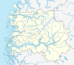
| Location in Sogn og Fjordane county | |
| Coordinates: 61°12′29″N 05°49′48″E / 61.20806°N 5.83000°ECoordinates: 61°12′29″N 05°49′48″E / 61.20806°N 5.83000°E | |
| Country | Norway |
| Region | Western Norway |
| County | Sogn og Fjordane |
| District | Sogn |
| Municipality | Høyanger |
| Area | |
| • Total | 0.36 km2 (0.14 sq mi) |
| Elevation | 7 m (23 ft) |
| Population (2013) | |
| • Total | 238 |
| • Density | 661/km2 (1,710/sq mi) |
| Time zone | CET (UTC+01:00) |
| • Summer (DST) | CEST (UTC+02:00) |
| Post Code | 6996 Vadheim |
Vadheim is a village in the municipality of Høyanger in Sogn og Fjordane county, Norway. It is located on the north shore of the Sognefjorden, along the small Vadheimsfjorden branch. The European route E39 highway runs through the village. It is located about 25 kilometres (16 mi) northeast of the village of Lavik, about 11 kilometres (6.8 mi) northwest of the village of Kyrkjebø, and about 13.5 kilometres (8.4 mi) northwest of the village of Austreim. The 0.36-square-kilometre (89-acre) village has a population (2013) of 238, giving the village a population density of 661 inhabitants per square kilometre (1,710/sq mi).
Vadheim is the resting place for one of the most famous warships of World War I. During that conflict, Germany converted a number of merchant ships to armed surface raiders. These ships cruised the world's shipping lanes and captured/sank Allied shipping. The most famous and successful of these was SMS Möwe. One of the ships she sank was Mount Temple which carried dinosaur fossils destined for the British Museum in London, England.Möwe survived the war. During World War II, under the name Oldenburg, was used in support of the occupation of Norway by Nazi Germany. On 7 April 1945 Bristol Beaufighter aircraft from No. 114 Squadron RAF, No. 455 Squadron RAAF, and No. 489 Squadron RNZAF sank Oldenburg at her moorings following an intense strafing and rocket attack.
...
Wikipedia


