Urup Island
| Native name: Уруп 得撫島 |
|
|---|---|

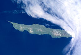
NASA picture of Urup Island
|
|
 |
|
| Geography | |
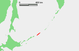
| Location | Sea of Okhotsk |
| Coordinates | 45°56′N 150°02′E / 45.933°N 150.033°E |
| Archipelago | Kuril Islands |
| Area | 1,430 km2 (550 sq mi) |
| Highest elevation | 1,426 m (4,678 ft) |
| Administration | |
|
Russia
|
|
| Demographics | |
| Population | 0 (2010) |
Urup (Russian: Уру́п, Japanese: 得撫島, translit. Uruppu-to, Ainu: ウルㇷ゚, translit. Urup) is an uninhabited volcanic island in the Kuril Islands chain in the south of the Sea of Okhotsk, northwest Pacific Ocean. Its name is derived from the Ainu language word for salmon trout. It was formerly known as Company's Land.
Urup has a roughly rectangular shape, measuring 120 kilometres (75 miles) along its long axis and approximately 20 kilometres (12 miles) along its narrow axis. It is the fourth largest of the Kuril Islands, with an area of 1,430 square kilometres (552 square miles). The highest point is Gora Ivao at 1,426 metres (4,678 ft).
The strait between Urup and Iturup is known as the Vries Strait, after Dutch explorer Maarten Gerritsz Vries, the first recorded European to explore the area. The strait between Urup and Simushir is known as Bussol Strait, after the French word for "compass", which was the name of one of La Pérouse's vessels. This French mariner explored the area of the Kuril Islands in 1787.
Urup consists of four major groups of active or dormant stratovolcanos:
...
Wikipedia
