Simushir
| Native name: Симушир 新知島 |
|
|---|---|

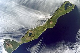
NASA picture of Simushir Island
|
|
 |
|
| Geography | |
| Location | Sea of Okhotsk |
| Coordinates | 46°58′N 152°02′E / 46.97°N 152.03°E |
| Archipelago | Kuril Islands |
| Area | 227.6 km2 (87.9 sq mi) |
| Highest elevation | 1,540 m (5,050 ft) |
| Administration | |
|
Russia
|
|
| Demographics | |
| Population | 0 |
Simushir (Russian: Симушир, Japanese: 新知島, Shimushiru-tō, Ainu: シムシㇼ, Simusir), meaning Large Island in Ainu, is an uninhabited volcanic island near the center of the Kuril Islands chain in the Sea of Okhotsk in the northwest Pacific Ocean. It was formerly known as Marikan.
At the time of European contact, Simushir was inhabited by the Ainu. The island appears on an official map showing the territories of Matsumae Domain, a feudal domain of Edo period Japan dated 1644, and these holdings were officially confirmed by the Tokugawa shogunate in 1715. Russian explorer Gerasim Izmailov was marooned on Simushir in the early 1770s. He spent a full year subsisting on "scallops, grass, and roots". Sovereignty initially passed to Russia under the terms of the Treaty of Shimoda, but was returned to the Empire of Japan per the Treaty of Saint Petersburg along with the rest of the Kuril islands. The island was formerly administered as part of Shimushiru District of Nemuro Subprefecture of Hokkaidō. Settlers on the island were engaged in fishing, and the raising of Arctic fox and reindeer. During World War II, the civilian population was evacuated to the Japanese home islands and Simushir was garrisoned by a detachment from the Imperial Japanese Army. It was surrendered to Soviet forces during the Battle of the Kuril Islands without resistance.
...
Wikipedia
