Upper Moreland Township, Pennsylvania
| Upper Moreland Township | |
| Township | |
|
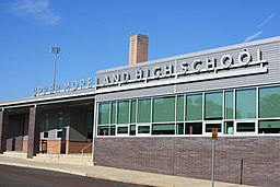
Upper Moreland High School
|
|
| Country | United States |
|---|---|
| State | Pennsylvania |
| County | Montgomery |
| Elevation | 203 ft (61.9 m) |
| Coordinates | 40°09′34″N 75°06′28″W / 40.15944°N 75.10778°WCoordinates: 40°09′34″N 75°06′28″W / 40.15944°N 75.10778°W |
| Area | 7.5 sq mi (19.4 km2) |
| - land | 7.5 sq mi (19 km2) |
| - water | 0.0 sq mi (0 km2), 0% |
| Population | 24,015 (2010) |
| Density | 3,202/sq mi (1,236.3/km2) |
| Timezone | EST (UTC-5) |
| - summer (DST) | EDT (UTC-4) |
| ZIP codes | 19006, 19040, 19090 |
| Area code | 215 and 267 |
|
Location of Upper Moreland Township in Montgomery County
|
|
|
Website: www |
|
Upper Moreland Township is a township in Montgomery County, Pennsylvania, United States. The population was 24,015 at the 2010 census. Upper Moreland Township is primarily a residential community with distinctive neighborhoods that are complemented by several thriving business, industrial, and commercial districts.
According to the United States Census Bureau, the township has a total area of 7.5 square miles (19 km2), all of it land. Upper Moreland is part of the Philadelphia Metropolitan Area and is approximately 15 miles (24 km) north of downtown Philadelphia. The township is bordered by the Montgomery County communities of Hatboro, Upper Dublin, Abington, Bryn Athyn, and Lower Moreland while Bucks County lies to the north.
As of the 2010 census, the township was 85.2% White, 5.1% Black or African American, 0.2% Native American, 4.4% Asian, 0.1% Native Hawaiian and Other Pacific Islander, 1.3% were Some Other Race, and 1.9% were two or more races. 3.6% of the population were of Hispanic or Latino ancestry.
As of the census of 2000, there were 24,993 people, 10,120 households, and 6,638 families residing in the township. The population density was 3,139.6 people per square mile (1,212.3/km2). There were 10,403 housing units at an average density of 1,306.8/sq mi (504.6/km2). The racial makeup of the township was 90.72% White, 4.36% African American, 0.10% Native American, 3.17% Asian, 0.02% Pacific Islander, 0.58% from other races, and 1.04% from two or more races. Hispanic or Latino of any race were 1.73% of the population.
...
Wikipedia


