United States Military Academy grounds and facilities
|
U.S. Military Academy
|
|

Cadet Chapel
|
|
| Location | NY 218, West Point, New York |
|---|---|
| Coordinates | 41°23′34″N 73°57′30″W / 41.3927°N 73.9584°W |
| Area | 2,500 acres (1,000 ha) |
| Built | 1775 |
| Architectural style | Classical Revival, Tudor Revival, Federal |
| NRHP Reference # | 66000562 |
| Significant dates | |
| Added to NRHP | 15 October 1966 |
| Designated NHLD | 15 October 1966 |
The United States Military Academy (West Point) and grounds were declared a National Historic Landmark in 1960 due to the Revolutionary War history and the age and historic significance of the Academy itself. The majority of the buildings in the central cadet area are historic.
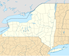
West Point is located approximately 50 miles (80 km) north of New York City on the western bank of the Hudson River. The Academy's geographic location and geologic formations have directly shaped its history. There wouldn't even be a military garrison at West Point were it not for the narrow "s-curve" in the river, literally creating a "west point" in the river that was so prominent and important for controlling shipping traffic on the Hudson during colonial times. In addition to the narrow double-90-degree turns, the currents and winds were erratic and unpredictable, making even an unopposed navigation difficult. In addition to the strategic shape of the Hudson River, the Highlands rise up sharply from river level to 1,400 feet (430 m) at some places in the immediate area. The combination of the narrow river turns and the commanding high ground made this place the perfect location for the Continental Army to build its stronghold against British troop movement into upstate New York during the American Revolution. The Continental Army first occupied the relatively level plain and constructed Fort Clinton and supporting redoubts and batteries of artillery on prominent hills in the area and across the river on Constitution Island. Guests of cadets who visit Flirtation Walk can experience glimpses of the Revolutionary War era terrain as the shoreline along the river below the plain has not changed much in over 200 years. It wasn't until after the war that congress actually purchased the land upon where Fort Clinton stood. In 1790, Congress purchased an initial tract of 1,700 acres (6.9 km2) from a Stephen Moore of North Carolina.
For the first hundred years of the Academy, ship-board traffic, then later rail-traffic, were the only ways to access West Point from New York City. In the years immediately following the Revolutionary War, the Hudson Highlands surrounding West Point were sparsely populated and often harbored "gangs of thieves". An 1819 letter from superintendent Sylvanus Thayer complained to the Secretary War John C. Calhoun of the lawlessness of the local inhabitants in the highlands surrounding West Point. As transportation technology improved and coal became the dominant source of energy consumption, the wildness of the highlands subsided and the hill people whose lives were linked to subsistence upon the forest began to disappear. By the turn of the century, the Academy had begun to expand beyond the immediate reaches of the Plain and grew both south along the river and westward into the highlands.
...
Wikipedia

