Union Square (Baltimore)
|
Union Square-Hollins Market Historic District
|
|

Union Square
|
|
| Location | Roughly bounded by Fulton, Fayette, Pratt and Schroeder Streets, Baltimore, Maryland |
|---|---|
| Coordinates | 39°17′13″N 76°38′25″W / 39.28694°N 76.64028°WCoordinates: 39°17′13″N 76°38′25″W / 39.28694°N 76.64028°W |
| Area | 479 acres (194 ha) |
| Built | 1830 |
| Architectural style | Greek Revival, Other, Federal, Italianate |
| NRHP Reference # | 83002941 |
| Added to NRHP | September 15, 1983 |
Union Square is a neighborhood located in the Sowebo area of Baltimore. It dates to the 1830s and includes a historic district of houses and commerce buildings.
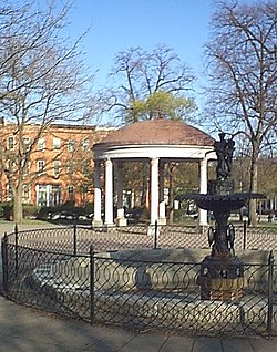
Named for the graceful park at its center, Union Square is a diverse urban setting - home to art galleries, artist studios, H.L. Mencken’s lifelong residence, and spacious three-story Italianate and Victorian rowhouses. On the historic ground of Southwest Baltimore is known to locals as "Sowebo" (SouthWest Baltimore). Union Square is less than a mile from Camden Yards and within walking distance of the "Inner Harbor" (formerly known as "The Basin" of the harbor, the Northwest Branch of the Patapsco River, the B&O Railroad Museum, Ravens Stadium (later known as M. & T. Bank Stadium), and the University of Maryland at Baltimore, (the original and founding campus of the U. of M. system, from 1807). The state-of-the-art U.M.B. Biotech Park on West Baltimore Street is a recent addition, with portions still under construction. One of the several public golf courses is nearby in Carroll Park, also home to the historic Mount Clare Mansion of 1754 built by Charles Carroll, Barrister, (1723-1783), next to the newly renovated Montgomery Park office building, formerly the store and regional warehouse of the Montgomery Ward & Company, famous for their catalog orders and sales in the last century. Access to several transportation directions are minutes away with the Martin Luther King, Jr. Boulevard running in an arch around the west side of downtown with its connection to the Jones Falls Expressway, (Interstate 83) going north towards the Baltimore-Harrisburg Expressway, the main East Coast highway, north to south is Interstate 95 with its Fort McHenry Tunnel and the Baltimore Harbor Tunnel cutting under the harbor and port of the Patapsco River and the commuter rail service MARC Train beginning in the northeastern corner of the state at Havre de Grace, Maryland|Havre de Grace]] at the head of the Chesapeake Bay down to Baltimore and onto Washington, D.C. 40 miles away. Surrounding the city is the encircling Baltimore Beltway which is also Interstate 695 and connects via four parallel highways, from east to west: Interstate 95, then the Baltimore-Washington Parkway which is also (Md. Route 295 and Interstate 295), and the old historic Washington Boulevard from colonial times now of U.S. Route 1, and further to the west is U.S. Route 29, all connecting to the Capital Beltway around the Nation's Capital, in Maryland and Virginia, Interstate 495.
...
Wikipedia

