Umm Salamuna
| Umm Salamuna | |
|---|---|
| Other transcription(s) | |
| • Arabic | خربة ام سلمونه |
| • Also spelled | Um Salmonah (official) Kirbat Umm Salamunah (unofficial) |

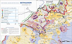
Area map, showing Umm Salamunu, north of Beit Fajjar, in 2011
|
|
| Location of Umm Salamuna within the Palestinian territories | |
| Coordinates: 31°38′36″N 35°10′05″E / 31.64333°N 35.16806°ECoordinates: 31°38′36″N 35°10′05″E / 31.64333°N 35.16806°E | |
| Palestine grid | 166/116 |
| Governorate | Bethlehem |
| Government | |
| • Type | Village council |
| Population (2007) | |
| • Jurisdiction | 945 |
| Name meaning | Umm Salamôni, the ruin of the mother of Salamôni |
Umm Salamuna (Arabic: خربة ام سلمونه) is a Palestinian village located twelve kilometers South-west of Bethlehem. The village is in the Bethlehem Governorate in the southern West Bank. According to the Palestinian Central Bureau of Statistics, the village had a population of 945 in 2007. The primary healthcare is obtained in Beit Fajjar where the Ministry of Heath have classified the care facilities as level 3.
In 1883, the Palestine Exploration Fund's Survey of Western Palestine noted "Heaps of stones" at Kh. Umm Salamôni.
In the 1931 census the population of Umm Salamuna was counted together with Beit Fajjar, Marah Ma'alla and Marah Rabah. The total population was 1043, all Muslims, in 258 houses.
...
Wikipedia

