Uluṟu–Kata Tjuṯa National Park
|
Uluṟu-Kata Tjuṯa National Park Northern Territory |
|
|---|---|
|
IUCN category II (national park)
|
|

Uluru (close) and Kata Tjuta (far)
|
|
| Nearest town or city | Yulara |
| Coordinates | 25°18′44″S 131°01′07″E / 25.31222°S 131.01861°ECoordinates: 25°18′44″S 131°01′07″E / 25.31222°S 131.01861°E |
| Established | 23 January 1958 |
| Area | 1,333.72 km2 (515.0 sq mi) |
| Managing authorities |
|
| Website | Uluṟu-Kata Tjuṯa National Park |
| See also | Protected areas of the Northern Territory |
 |
|
| UNESCO World Heritage Site | |
|---|---|
| Location |
Australia |
| Area | 1,333.72 km2 (1.43560×10¹⁰ sq ft) |
| Criteria | v, vi, vii, ix |
| Reference | 447 |
| Coordinates | 25°18′44″S 131°01′07″E / 25.3122°S 131.0186°E |
| Inscription | 1987 (11th Session) |
| Extensions | 1994 |
| Website |
www |
|
[]
|
|
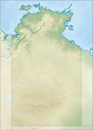
Uluṟu-Kata Tjuṯa National Park is a national park located in Northern Territory, Australia. The park is home to both Uluru and Kata Tjuta. It is located 1431 kilometres south of Darwin by road and 440 kilometres (270 mi) south-west of Alice Springs along the Stuart and Lasseter Highways. The park covers 1,326 square kilometres (512 sq mi) and includes the features it is named after: Uluru/Ayers Rock and, 40 kilometres (25 mi) to its west, Kata Tjuta/Mount Olga. The location is listed with UNESCO World Heritage sites.
Uluru is Australia’s most recognizable natural icon and has become a focal point for Australia and the world's acknowledgement of Australian indigenous culture. The sandstone monolith stands 348 metres high with most of its bulk below the ground. To Anangu (local indigenous people), Uluru is a place name and this "Rock" has a number of different landmarks where many ancestral beings have interacted with the landscape and/or each other, some even believed to still reside here. Kata Tjuta, meaning ‘many heads’, is a sacred place relating to knowledge that is considered very powerful and dangerous, only suitable for initiated men. It is made up of a group of 36 conglomerate rock domes that date back 500 million years.
Anangu are the traditional Aboriginal owners of Uluru-Kata Tjuta National Park. They believe that their culture was created at the beginning of time by ancestral beings. Uluru and Kata Tjuta provide physical evidence of feats performed during the creation period. They often lead walking tours to inform visitors about the local flora and fauna, bush foods and the Aboriginal Dreamtime stories of the area.
The Aboriginal Land Rights (Northern Territory) Act was passed in 1976, meaning that after many years Aboriginal law and land rights were finally recognised in Australian law. Nine years later in 1985 the traditional owners were presented with the freehold title deeds for the park, who, in turn, leased the land back to the Australian Government through the Director of National Parks (formerly the Australian National Parks and Wildlife Service) for 99 years. The Director is assisted by Parks Australia (a division of the Department of the Environment and Water Resources). Since hand-back, Anangu and Parks Australia staff have worked together to manage the park. This process of working together is known as 'joint management'.
...
Wikipedia


