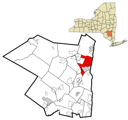
Ulster, New York
| Ulster, New York | |
|---|---|
| Town | |
 Location in Ulster County and the state of New York. |
|
| Coordinates: 41°57′38″N 74°0′39″W / 41.96056°N 74.01083°WCoordinates: 41°57′38″N 74°0′39″W / 41.96056°N 74.01083°W | |
| Country | United States |
| State | New York |
| County | Ulster |
| Area | |
| • Total | 28.9 sq mi (74.8 km2) |
| • Land | 26.8 sq mi (69.4 km2) |
| • Water | 2.1 sq mi (5.4 km2) |
| Elevation | 161 ft (49 m) |
| Population (2010) | |
| • Total | 12,327 |
| Time zone | Eastern (EST) (UTC-5) |
| • Summer (DST) | EDT (UTC-4) |
| FIPS code | 36-75935 |
| GNIS feature ID | 0979569 |
Ulster is a town in Ulster County, New York, United States. The population was 12,327 at the 2010 census.
The Town of Ulster is in the northeast part of the county. The town is directly north of the City of Kingston. Ulster is partially inside Catskill Park.
The New York State Thruway (Interstate 87) and U.S. Route 9W pass through the western part of the town. US Route 209 crosses the Hudson River from the east side of the town.
The Town of Ulster, youngest of the twenty towns in the county, was created by an act of the Ulster County Board of Supervisors on November 28, 1879 when the supervisors voted to form the new township with land taken from the Town of Kingston. Formed in protest to what was considered political misrule by the authorities of the Town of Kingston, the action of the supervisors was soon ratified by the state legislature. The first meeting of the Town of Ulster was held in the hotel of George A. Stoddard on the first Tuesday of March 1880. James Myer, Jr. was selected to be its first Supervisor. The newly created town contained approximately 27.5 square miles of land. It bordered the City of Kingston on three sides and was bordered by the Hudson River and the Towns of Kingston, Saugerties, Hurley, Woodstock, and Rosendale. The Rondout Creek separated the Town of Ulster from the Town of Esopus to the South.
"While the establishment of Ulster solved the problem of political corruption in the parent Town of Kingston, another problem was inadvertently created. When the boundaries of Ulster were established, it was obvious just how severe the punishment of the Town of Kingston had been: the new town had Eddyville with the Delaware-Hudson Canal Terminus lock, the land bordering the Hudson with its icehouses and brickyards and all the advantages for trade and travel, the flat farm land of the Saugerties Road and the Brabant with its road leading into the interior. The Esopus Creek with all the potential for mills was locate within the new town. Finding a Centrum or hub around which the township could unite was virtually impossible as it was little more than a collection of hamlets bound together by only a legislative act." (Burgher manuscript)
...
Wikipedia
