Uliastai
|
Uliastai Улиастай ᠤᠯᠢᠶ᠋ᠠᠰᠤᠲᠠᠢ |
|
|---|---|
| District | |
|
Uliastai District Улиастай сум ᠤᠯᠢᠶ᠋ᠠᠰᠤᠲᠠᠢᠰᠤᠮᠤ |
|

Manchurian Stone near Chigestei Gol. The Chinese characters translate to, "Blue Dragon Bridge"
|
|
| Coordinates: 47°44′34″N 96°50′36″E / 47.74278°N 96.84333°E | |
| Country | Mongolia |
| Province | Zavkhan Province |
| Founded | 1733 |
| Area | |
| • Total | 32.04 km2 (12.37 sq mi) |
| Elevation | 1,753 m (5,751 ft) |
| Population (2012) | |
| • Total | 15,460 |
| • Density | 480/km2 (1,200/sq mi) |
| Time zone | UTC + 8 (UTC+8) |
| Area code(s) | +976 (0)146 |
| Climate | BSk |
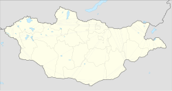
Uliastai (Mongolian: Улиастай; ᠣᠯᠢᠶᠠᠰᠦᠲᠠᠢ), also spelled Uliyasutai or Oulia-Sontai, and sometimes known as Javkhlant, is a city in Mongolia located in the western part of the country and 1,115 kilometres (693 mi) from the capital Ulaanbaatar. Uliastai is the capital of Zavkhan Province and was the 10th most populous city in the country with a population of 24,276 (2000 census). However, recent estimates have the city's population at 16,240 (2006 est[update].) making it the 16th most populous city in Mongolia.
Uliastai is located in a river valley where the Chigestai and Bogdiin Gol rivers meet, and is surrounded by mountains on all sides. It is one of the most remote aimag capitals in Mongolia. Uliastai city has sum (district) status and forms an enclave within the surrounding Aldarkhaan sum.
Alongside Khovd, Uliastai is one of the oldest settlements in Mongolia, and has long been an important center of caravan trade even into the 20th century. It was connected by camel caravan routes with Urga (now Ulaanbaatar) in the east, Khovd in the west, Barkol and other points in Xinjiang in the southwest, and Hohhot in the southeast.
...
Wikipedia

