Uberlandia
| Uberlândia | ||
|---|---|---|
| Municipality | ||
|
Município de Uberlândia Municipality of Uberlândia |
||

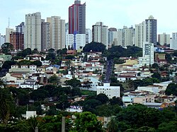
Downtown Uberlandia in mid-November 2011
|
||
|
||
| Nickname(s): Udi, Capital Logistics, Greater Pole Wholesale in Latin America | ||
 Localization of Uberlândia in Minas Gerais |
||
| Localization of Uberlândia in Brazil | ||
| Coordinates: 18°55′23″S 48°17′19″W / 18.92306°S 48.28861°W | ||
| Country | Brazil | |
| Region | Southeast | |
| State | Minas Gerais | |
| Founded | 31 August 1888 | |
| Government | ||
| • Mayor | Gilmar Machado (PT) | |
| Area | ||
| • Total | 4,115.9 km2 (1,589.2 sq mi) | |
| Elevation | 863 m (2,831 ft) | |
| Population (2014) | ||
| • Total | 654,681 | |
| • Density | 157,12/km2 (40,690/sq mi) | |
| Demonym(s) | Uberlandense | |
| Time zone | UTC-3 (UTC-3) | |
| • Summer (DST) | UTC-2 (UTC-2) | |
| Postal Code (CEP) | 38400-000 | |
| Area code(s) | +55 34 | |
| Website | www.uberlandia.mg.gov.br | |
Uberlândia (Portuguese pronunciation: [ubɛxˈlɐ̃d͡ʒiɐ]) is a municipality in the state of Minas Gerais, southeastern Brazil.
With a population of 654,681 inhabitants, according to 2014 estimates, the city is the second largest in the state second only to Belo Horizonte (2,491,109).
The city is served by Uberlândia–Ten. Cel. Av. César Bombonato Airport.
Uberlândia is located in the western part of the state of Minas Gerais, in the region called Triângulo Mineiro, one of the richest agricultural regions of Brazil, between the Paranaíba and Grande rivers. It is connected to major cities by the following federal highways: BR-050, BR-365, BR-455, BR-452, and BR-497. Uberlândia is about 580 km away from São Paulo, connected by a modern and safe double trace highway (BR-050). The capital of the state of Minas Gerais, Belo Horizonte, is 560 km away and Brasília, the capital of the country, lies just 440 km to the north. There are railways connecting Uberlândia via the north-south Centro-Atlântica line.
Uberlândia is a statistical micro-region including the following municipalities: Araguari, Araporã, Canápolis, Cascalho Rico, Centralina, Indianópolis, Monte Alegre de Minas, Prata, Tupaciguara, and Uberlândia. In 2007 the population of these cities' agglomeration was 818,395 inhabitants in a total area of 18,864.20 km². The population density (2000) was 43.38 inhab/km².
...
Wikipedia


