US Highway 61
| U.S. Route 61 | |
|---|---|
 |
|
| Route information | |
| Length: | 1,406.86 mi (2,264.12 km) |
| Existed: | 1926 – present |
| Major junctions | |
| South end: |
|
|
|
| North end: |
|
| Location | |
| States: | Louisiana, Mississippi, Tennessee, Arkansas, Missouri, Iowa, Wisconsin, Minnesota |
| Highway system | |
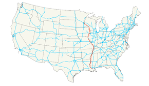
U.S. Route 61 (US 61) is the official designation for a United States highway that runs 1,400 miles (2,300 km) between New Orleans, Louisiana, and the city of Wyoming, Minnesota. The highway generally follows the course of the Mississippi River, and is designated the Great River Road for much of its route. As of 2004, the highway's northern terminus in Wyoming, Minnesota, is at an intersection with Interstate 35 (I-35). Until 1991, the highway extended north on what is now Minnesota State Highway 61 (MN 61) through Duluth to the Canada–US border near Grand Portage. Its southern terminus in New Orleans, Louisiana, is at an intersection with Tulane Avenue at South Broad Street. The highway is often called the Blues Highway because it connects Saint Paul, Minnesota; St. Louis, Missouri; Memphis, Tennessee; the Mississippi Delta, and New Orleans.
The route was an important south-north connection in the days before the interstate highway system. Many southerners traveled north along US 61 while going to St. Louis and Saint Paul.
...
Wikipedia

