Tyringham, Massachusetts
| Tyringham, Massachusetts | ||
|---|---|---|
| Town | ||

Santarella, the home of Henry Hudson Kitson
|
||
|
||
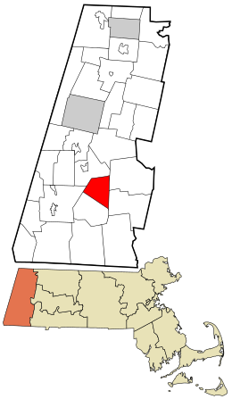
 Location in Berkshire County and the state of Massachusetts. |
||
| Coordinates: 42°14′45″N 73°12′15″W / 42.24583°N 73.20417°WCoordinates: 42°14′45″N 73°12′15″W / 42.24583°N 73.20417°W | ||
| Country | United States | |
| State | Massachusetts | |
| County | Berkshire | |
| Settled | 1735 | |
| Incorporated | 1762 | |
| Government | ||
| • Type | Open town meeting | |
| Area | ||
| • Total | 18.9 sq mi (48.9 km2) | |
| • Land | 18.6 sq mi (48.3 km2) | |
| • Water | 0.2 sq mi (0.6 km2) | |
| Elevation | 901 ft (275 m) | |
| Population (2010) | ||
| • Total | 327 | |
| • Density | 18/sq mi (6.8/km2) | |
| Time zone | Eastern (UTC-5) | |
| • Summer (DST) | Eastern (UTC-4) | |
| ZIP code | 01264 | |
| Area code(s) | 413 | |
| FIPS code | 25-71095 | |
| GNIS feature ID | 0619429 | |
Tyringham is a town in Berkshire County, Massachusetts, United States. It is part of the Pittsfield, Massachusetts Metropolitan Statistical Area. The population was 327 at the 2010 census.
Founded as Housatonic Township Number 1, the land which became Tyringham and Monterey was first settled in 1735. The two main villages were set up along two waterways, Hop Brook to the north and the Konkapot River to the south. In 1750, Adonijah Bidwell, a Yale Divinity School graduate from the Hartford region, became the first minister of Township No. 1. When a meetinghouse was founded in the south, it led to a buildup in the north, and by 1767 the town was incorporated and named for Tyringham, a village in Buckinghamshire, England. The town was home to the Tyringham Shaker Settlement Historic District, with the Shaker holy name of "Jerusalem", which lay just south of the town center. The town of Monterey was set off and incorporated as its own town in 1847. The town was the site of several small country estates for the wealthy, most of which are long gone, leaving Tyringham as a small, rural community.
According to the United States Census Bureau, the town has a total area of 18.9 square miles (48.9 km2), of which 18.6 square miles (48.3 km2) is land and 0.23 square miles (0.6 km2), or 1.20%, is water. The town is four-sided, bordered by Lee to the north, Becket and Otis to the east, Monterey to the south, and Great Barrington to the west. Tyringham is located 16 miles (26 km) south of Pittsfield, 39 miles (63 km) west-northwest of Springfield, and 125 miles (201 km) west of Boston.
...
Wikipedia

