Otis, Massachusetts
| Otis, Massachusetts | ||
|---|---|---|
| Town | ||

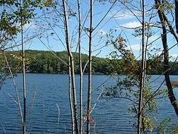
Benton Pond, East Otis
|
||
|
||
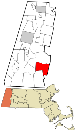
 Location in Berkshire County and the state of Massachusetts. |
||
| Coordinates: 42°11′35″N 73°05′32″W / 42.19306°N 73.09222°WCoordinates: 42°11′35″N 73°05′32″W / 42.19306°N 73.09222°W | ||
| Country | United States | |
| State | Massachusetts | |
| County | Berkshire | |
| Settled | 1735 | |
| Incorporated (as Loudon) | 1773 | |
| Incorporated (as Otis) | June 13, 1810 | |
| Government | ||
| • Type | Open town meeting | |
| Area | ||
| • Total | 38.0 sq mi (98.5 km2) | |
| • Land | 35.6 sq mi (92.1 km2) | |
| • Water | 2.5 sq mi (6.5 km2) | |
| Elevation | 1,220 ft (372 m) | |
| Population (2010) | ||
| • Total | 1,612 | |
| • Density | 45/sq mi (17.5/km2) | |
| Time zone | Eastern (UTC-5) | |
| • Summer (DST) | Eastern (UTC-4) | |
| ZIP code | 01253 | |
| Area code(s) | 413 | |
| FIPS code | 25-51580 | |
| GNIS feature ID | 0619422 | |
| Website | www |
|
Otis is a town in Berkshire County, Massachusetts, United States. It is part of the Pittsfield, Massachusetts Metropolitan Statistical Area. The population was 1,612 at the 2010 census.
For geographic and demographic information on East Otis, which is part of the town of Otis, see East Otis, Massachusetts. The numbers reported in that article are included in the figures below.
Officially incorporated in 1810, the town was created when the unincorporated town of Loudon annexed the adjacent District of Bethlehem in 1809. It was named after Harrison Gray Otis, an influential lawyer, financier, and politician in revolutionary Massachusetts. General Henry Knox passed through the town in January 1776, bringing cannons from Fort Ticonderoga in New York to aid in ending the Siege of Boston, a route now known as the Knox Trail. The town was a farming community, with several small mill industries growing along the waterways, and today is mostly rural with some tourism.
According to the United States Census Bureau, the town has a total area of 38.0 square miles (98.5 km2), of which 35.6 square miles (92.1 km2) is land and 2.5 square miles (6.5 km2), or 6.55%, is water. Otis lies along the eastern border of Berkshire County with Hampden County, bordered by Becket to the north, Blandford to the east, Tolland to the southeast, Sandisfield to the south, and Monterey and Tyringham to the west. Otis is 23 miles (37 km) southeast of Pittsfield, 30 miles (48 km) west-northwest of Springfield, and 116 miles (187 km) west of Boston.
...
Wikipedia

