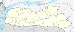
Tura, Meghalaya
| Tura | |
|---|---|
| Town | |
| Location in Meghalaya, India | |
| Coordinates: 25°31′N 90°13′E / 25.52°N 90.22°ECoordinates: 25°31′N 90°13′E / 25.52°N 90.22°E | |
| Country |
|
| State | Meghalaya |
| District | West Garo Hills |
| Autonomous Regions of India | GHADC |
| Elevation | 349 m (1,145 ft) |
| Population (2011) | |
| • Total | 74,858 |
| Languages | |
| • Local | Garo |
| • Official | Garo and English |
| Time zone | IST (UTC+5:30) |
| Telephone code | 03651 |
| Vehicle registration | ML 08 |
| Climate | Cwa |
Tura (IPA: ˈtʊərə) is a hilly town and a municipality in West Garo Hills district in the Indian state of Meghalaya. One of the largest towns in Meghalaya, Tura is a valley located at the foothills of the Tura Hills and right below the Tura Peak. The climate in Tura is moderate throughout the year and has a large number of interesting and unexplored areas. The native god Durama was believed to reside in the hills. The name Tura is said to be a corruption (by the British) of the god's name.
It is 220 kilometres from the nearest city Guwahati and is also the district capital of the West Garo Hills district. It is filled with small rivulets and green valleys all around. The principal languages are Garo and English. The city has 4 colleges and a host of good secondary schools. In 1973, the town was made the seat of the Roman Catholic Diocese of Tura.
The capital city of Shillong is 323 kilometres away and can be accessed via buses or the shuttle helicopter service. The border of Bangladesh Dalu, is situated at a proximity of 50 kilometres.
Tura is a cultural and administrative centre of the Garo tribes. To visit popular tourist destinations such as Balpakram, Nokrek and Siju Cave, one needs to pass through this town.
There are many water falls and lot of streams in Tura. Some of the water falls are Rongbangdare, Pelgadare, Gandrak Falls etc. Some of the streams are Rangolwari, Nokmawari, Ganol, Dachima etc.
Tura is located at 25°31′N 90°13′E / 25.52°N 90.22°E. It has an average elevation of 349 metres (1145 feet).
...
Wikipedia


