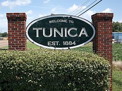
Tunica, Mississippi
| Tunica, Mississippi | |
|---|---|
| Town | |
 |
|
 Location of Tunica in Tunica County |
|
| Location in the United States | |
| Coordinates: 34°41′20″N 90°22′50″W / 34.68889°N 90.38056°WCoordinates: 34°41′20″N 90°22′50″W / 34.68889°N 90.38056°W | |
| Country | United States |
| State | Mississippi |
| County | Tunica |
| Incorporated | 1888 |
| Area | |
| • Total | 0.7 sq mi (1.8 km2) |
| • Land | 0.7 sq mi (1.8 km2) |
| • Water | 0.0 sq mi (0.0 km2) |
| Elevation | 197 ft (60 m) |
| Population (2000) | |
| • Total | 1,132 |
| • Density | 1,588.4/sq mi (613.3/km2) |
| Time zone | CST (UTC-6) |
| • Summer (DST) | CDT (UTC-5) |
| ZIP code | 38676 |
| Area code(s) | 662 |
| FIPS code | 28-74760 |
| GNIS feature ID | 0678927 |
| Website | townoftunica.com |
Tunica is a town in and the county seat of Tunica County, Mississippi, near the Mississippi River. Until the early 1990s, the rural town was one of the most impoverished places in the United States, and its population has declined since the peak in 1970.
Tunica is the fourth community to serve as county seat of Tunica County, succeeding earlier county seats at Commerce (1839–1842, 1842–1847), Peyton (1842, temporary) and Austin (1847–1888).
Tunica gained national attention for its deprived neighborhood known as "Sugar Ditch Alley", named for the open sewer located there. Its fortunes have improved since development of a gambling resort area nearby. While population growth has occurred mostly outside Tunica, the major casinos employ numerous locals. They attract visitors from nearby Memphis, Tennessee, West Memphis, Arkansas and all over the Southeastern United States.
Tunica is located approximately 20 miles (32 km) south of Downtown Memphis, Tennessee.
According to the United States Census Bureau, the town has a total area of 0.7 square miles (1.8 km2), all land.
As of the census of 2000, there were 1,132 people, 537 households, and 254 families residing in the town. The population density was 1,588.4 people per square mile (615.6/km²). There were 592 housing units at an average density of 830.7 per square mile (321.9/km²). The racial makeup of the town was 67.84% White, 29.42% African American, 0.27% Native American, 1.06% Asian, 0.88% from other races, and 0.53% from two or more races. Hispanic or Latino of any race were 2.30% of the population.
...
Wikipedia

