Tumut Shire
|
Tumut Shire New South Wales |
|||||||||||||
|---|---|---|---|---|---|---|---|---|---|---|---|---|---|

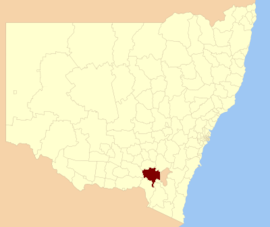
Location in New South Wales
|
|||||||||||||
| Coordinates | 35°18′S 148°13′E / 35.300°S 148.217°ECoordinates: 35°18′S 148°13′E / 35.300°S 148.217°E | ||||||||||||
| Population | 11,316 (2013 est) | ||||||||||||
| • Density | 2.4783/km2 (6.4188/sq mi) | ||||||||||||
| Established | 1928 | ||||||||||||
| Abolished | 12 May 2016 | ||||||||||||
| Area | 4,566 km2 (1,762.9 sq mi) | ||||||||||||
| Mayor | Sue Bulger | ||||||||||||
| Council seat | Tumut | ||||||||||||
| Region | South West Slopes | ||||||||||||
| State electorate(s) | Wagga Wagga | ||||||||||||
| Federal Division(s) | Riverina | ||||||||||||
| Website | Tumut Shire | ||||||||||||
|
|||||||||||||
Tumut Shire /ˈtjuːmət/ was a local government area in the South West Slopes region of New South Wales, Australia.
Tumut Shire was established in 1928 by the amalgamation of the Municipality of Tumut with the surrounding Gadara Shire.
A 2015 review of local government boundaries recommended that the Tumut Shire merge with the Tumbarumba Shire to form a new council with an area of 8,960 square kilometres (3,460 sq mi) and support a population of approximately 14,953. On 12 May 2016, the Tumut Shire merged with the Tumbarumba Shire to form the Snowy Valleys Council.
The last mayor of Tumut Shire was Cr. Sue Bulger, an independent politician.
The former Shire included the town of Tumut and the small towns of Gilmore, Adelong, Grahamstown, Gocup, Brungle, Talbingo, Wondalga, Batlow, Killimicat and Cabramurra.
...
Wikipedia
