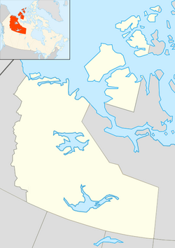
Tuktoyaktuk, Northwest Territories
|
Tuktoyaktuk Tuktuyaaqtuuq formerly Port Brabant |
|
|---|---|
| Hamlet | |

DEW line radar station at Tuktoyaktuk
|
|
| Nickname(s): Tuk | |
| Coordinates: 69°26′34″N 133°01′52″W / 69.44278°N 133.03111°WCoordinates: 69°26′34″N 133°01′52″W / 69.44278°N 133.03111°W | |
| Country | Canada |
| Territory |
|
| Region | Inuvik Region |
| Electoral district | Nunakput |
| Census division | Region 1 |
| Settled | 1928 |
| Incorporated | 1 April 1970 |
| Government | |
| • Mayor | Darrel Nasogaluak |
| • Senior Administrative Officer | Terry Testart |
| • MLA | Herbert Nakimayak |
| • Member of Parliament | Michael McLeod |
| • Senator | Nick Sibbeston |
| Area | |
| • Land | 13.90 km2 (5.37 sq mi) |
| Elevation | 5 m (15 ft) |
| Population (2011) | |
| • Total | 854 |
| • Density | 61.4/km2 (159/sq mi) |
| Time zone | MST (UTC-7) |
| • Summer (DST) | MDT (UTC-6) |
| Canadian Postal code | X0E 1C0 |
| Area code(s) | 867 |
| Telephone exchange | 977 |
| - Living cost | 172.5 |
| - Food price index | 161.6 |
| Website | www.tuk.ca/ |
| Sources: Department of Municipal and Community Affairs, Prince of Wales Northern Heritage Centre, Canada Flight Supplement Northwestel Natural Resources Canada ^A 2009 figure based on Edmonton = 100 ^B 2010 figure based on Yellowknife = 100 |
|
Tuktoyaktuk English /tʌktəˈjæktʌk/, or Tuktuyaaqtuuqt (Inuvialuktun: it looks like a caribou), is an Inuvialuit hamlet located in the Inuvik Region of the Northwest Territories, Canada. Commonly referred to simply by its first syllable, Tuk /tʌk/, the settlement lies north of the Arctic Circle on the shore of the Arctic Ocean. Formerly known as Port Brabant, the community was renamed in 1950 and was the first place in Canada to revert to the traditional Native name.
Tuktoyaktuk is the anglicized form of the native Inuvialuit place-name, meaning "resembling a caribou." According to legend, a woman looked on as some caribou, common at the site, waded into the water and turned into stone, or became petrified. Today, reefs resembling these petrified caribou are said to be visible at low tide along the shore of the town.
No formal archaeological sites exist today, but the settlement has been used by the native Inuvialuit for centuries as a place to harvest caribou and beluga whales. In addition, Tuktoyaktuk's natural harbour was historically used as a means to transport supplies to other Inuvialuit settlements.
...
Wikipedia

