Tsyp-Navolok
| Tsypnavolok (English) Цыпнаволок (Russian) |
|
|---|---|
| - Rural locality - Inhabited locality |
|
 Cape Tsypnavolok |
|
 Location of Murmansk Oblast in Russia |
|
|
|
|
|
|
|
| Administrative status | |
| Country | Russia |
| Federal subject | Murmansk Oblast |
| Statistics | |
| Population (2010 Census) | 35 inhabitants |
| Time zone | MSK (UTC+03:00) |
| Founded | 1867 |
| Postal code(s) | 184411 |
| Dialing code(s) | +7 81544 |
| on | |
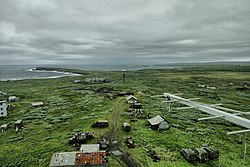
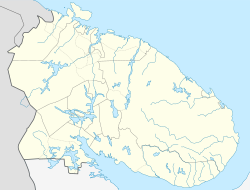
Tsypnavolok or Tsyp-Navolok (Russian: Цыпнаволок, Цып-Наволок) is a rural locality (an inhabited locality) in Pechengsky District of Murmansk Oblast, Russia, located on the Rybachy Peninsula by Cape Tsypnavolok, by the Barents Sea.
During the 1860s, the Murmansk coast of the Kola Peninsula was actively being settled. In 1867, a fisherman village was established by Kola Norwegians by the cape. In 1929, 114 Norwegians were registered in the area, and therefore a Norwegian national selsoviet was established in 1930. In 1940, the Norwegians were transferred during the ethnic cleansing campaigns near the border, and the selsoviet was abolished. After World War II, the Norwegians were allowed to return to Murmansk Oblast, but they were to be settled in Port-Vladimir.
Currently Tsypnavolok hosts a military unit, a weather station, and a lighthouse.
Accumulations of sulfide (chalcopyrite, galena, pyrite, sphalerite) nodules in turbidites are found in the area.
...
Wikipedia

