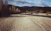
Towamba, New South Wales
|
Towamba New South Wales |
|
|---|---|

Towamba River
|
|
| Coordinates | 37°05′S 149°41′E / 37.083°S 149.683°ECoordinates: 37°05′S 149°41′E / 37.083°S 149.683°E |
| Population | 234 (2016 census) |
| Postcode(s) | 2550 |
| LGA(s) | Bega Valley Shire |
| State electorate(s) | Bega |
| Federal Division(s) | Eden-Monaro |
Towamba is a small community, in New South Wales, Australia in Bega Valley Shire. It is located about forty minutes' drive west of Eden. At the 2016 census, Towamba had a population of 234 people.
Along with settlements such as Burragate, Pericoe, Rocky Hall and Kiah, Towamba was one of the settlements established after Benjamin Boyd began to open up the area to European settlement in the 1840s and 1850s.
This small community has had a public school since 1862 located in Towamba Street. The original ford crossing the Towamba River was opposite the old Police Station, now a private dwelling. The first bridge built across the river was swept away in the 1919 floods where every bridge on the river was swept away.
In 1889, following a cricket match at Millpoint Pass, when Towamba defeated nearby Pericoe, members of the losing team returned with guns to set about killing the victors. A reliable account of what occurred is unavailable, a painting by William Laing at the Eden Killer Whale Museum provides, at least, a record of this (supposed) bizarre event.
Towamba remains a small service centre for the neighbouring agricultural community.
...
Wikipedia

