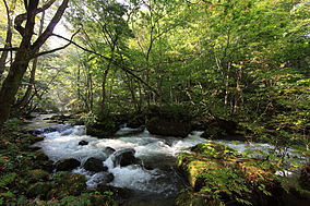
Towada-Hachimantai National Park
| Towada-Hachimantai National Park | |
|---|---|
| 十和田八幡平国立公園 | |
|
IUCN category II (national park)
|
|

|
|
| Towada-Hachimantai National Park in Japan | |
| Location | Tōhoku, Japan |
| Coordinates | 40°43′59.88″N 140°43′1.2″E / 40.7333000°N 140.717000°ECoordinates: 40°43′59.88″N 140°43′1.2″E / 40.7333000°N 140.717000°E |
| Area | 854 square kilometres (330 sq mi) |
| Established | 1 February 1936 |
Towada-Hachimantai National Park (十和田八幡平国立公園 Towada-Hachimantai Kokuritsu Kōen?) is a national park comprising two separate areas of Aomori, Iwate, and Akita Prefectures, Japan. The Towada-Hakkōda area encompasses Lake Towada, Mount Hakkōda, and most of the Oirase River valley. The Hachimantai area includes Mount Hachimantai, Mount Iwate, Tamagawa Onsen, and Akita Komagatake (?). The two areas are 50 kilometres (31 mi) apart, and cover 854 square kilometres (330 sq mi).
...
Wikipedia

