Tokke
| Tokke kommune | |||
|---|---|---|---|
| Municipality | |||
|
|||
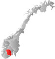
 Tokke within Telemark |
|||
| Coordinates: 59°25′2″N 7°58′43″E / 59.41722°N 7.97861°ECoordinates: 59°25′2″N 7°58′43″E / 59.41722°N 7.97861°E | |||
| Country | Norway | ||
| County | Telemark | ||
| District | Vest-Telemark | ||
| Administrative centre | Dalen | ||
| Government | |||
| • Mayor (2015) | Jarand Felland (Sp) | ||
| Area | |||
| • Total | 984 km2 (380 sq mi) | ||
| • Land | 905 km2 (349 sq mi) | ||
| Area rank | 107 in Norway | ||
| Population (2010) | |||
| • Total | 2,337 | ||
| • Rank | 310 in Norway | ||
| • Density | 2.58/km2 (6.7/sq mi) | ||
| • Change (10 years) | -6.7 % | ||
| Demonym(s) | Tokkebu | ||
| Time zone | CET (UTC+1) | ||
| • Summer (DST) | CEST (UTC+2) | ||
| ISO 3166 code | NO-0833 | ||
| Official language form | Nynorsk | ||
| Website | www |
||
|
|
|||
Tokke is a municipality in Telemark county, Norway. It is part of the traditional region of Vest-Telemark. The administrative centre of the municipality is the village of Dalen. The municipality of Tokke was created on 1 January 1964 upon the merger of the two older municipalities of Lårdal and Mo. Located in Lårdal, Eidsborg stave church is one of Norway's old stave churches.
The name originally belongs to the river running through the municipality. The Old Norse form of the river name must have been Þotka and it is related to the name of the lake Totak (which it comes from). The river name is probably derived from the Norse word þot meaning "roaring, rushing, or howling".
The coat-of-arms is from modern times. They were granted on 6 February 1987. The arms show a black bear on a gold background. The bear in the arms symbolizes the rich nature in the forests in the municipality. The bear plays a major role in many local legends and stories.
Tokke borders Vinje, Kviteseid, Seljord, Fyresdal, Valle, and Bykle. The highest peak is Urdenosi which is 1,520 metres (4,990 ft) above sea level.
...
Wikipedia


