Tlacotalpan
| Tlacotalpan | |
|---|---|
| City & Town | |

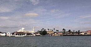
Tlacotalpan waterfront
|
|
| Coordinates: 18°37′N 95°40′W / 18.617°N 95.667°WCoordinates: 18°37′N 95°40′W / 18.617°N 95.667°W | |
| Country |
|
| State | Veracruz |
| Town status | 1847 |
| City status | 9 May 1865 |
| Elevation | 10 m (30 ft) |
| Population (2010) | |
| • Total | 8,853 |
| Time zone | CST (UTC-6) |
| Website | Municipio de Tlacotalpan |
| Official name | Historic Monuments Zone of Tlacotalpan |
| Type | Cultural |
| Criteria | ii, iv |
| Designated | 1998 (22nd session) |
| Reference no. | 862 |
| State Party | Mexico |
| Region | Latin America and the Caribbean |
Tlacotalpan is a town in Tlacotalpan Municipality in the Mexican state of Veracruz, declared a World Heritage Site by UNESCO in 1998 primarily for its architecture and colonial-era layout. The town was established in 1550 on what was originally an island in the Papaloapan River. From the colonial era to the 20th century, it was an important port, one of few interior river ports in Latin America. However, with the construction of the railroad, Tlacotalpan’s importance faded. Starting in the latter 20th century, efforts to conserve the town’s Spanish/Caribbean architecture and layout began, culminating in World Heritage status. Today, its main economic support is fishing and tourism, especially to the annual feast in honor of Our Lady of Candlemas.
It is nicknamed the “pearl of the Papaloapan.”
Tlacotalpan is distinct among most urban settlements in Latin America as it is a river port set back from the ocean. It is a World Heritage Site because of its layout, architecture, history and traditions. The urban layout and architecture date back to the 17th century and the town has mostly conserved both. The layout is a checkboard, covering 153 blocks on 75 hectares. This is divided into two sections: a “Spanish” section in the west and a smaller “native” one in the east, separated by a public area with commercial and official buildings along with some public spaces. The Spanish section of town is characterized by wide streets that parallel the Papaloapan River and connected by narrow lanes. Through this area, there are parks, and public spaces with mature trees, such as the Parque Hidalgo, noted for wandering musicians and Plazuela de Doña Maria, just east of the center, in the oldest section of town, surrounded by workshops that make furniture, musical instruments and other fine wood products. The architecture is characterized by one and two-story colonnaded houses Andalucian style inner courtyards, Caribbean-style arches, red-tile roofs and colorful facades, some of which date to the 18th century. These are particularly abundant in the San Miguelito and La Candelaria neighborhoods. Many of the houses still retain their interior layout and even traditional furnishings.
Although past its heyday in the 19th century, Tlacotalpan is still classified as a river port by the Mexican government, mostly serving fishing boats and small naval patrols. It has a cement dock 160 meters long, and a boardwalk along the river, much of it lined with restaurants.
...
Wikipedia

