Tisovec
| Tisovec | |
| Town | |
|
Building of municipality office in Tisovec
|
|
| Country | Slovakia |
|---|---|
| Region | Banská Bystrica |
| District | Rimavská Sobota |
| Tourism region | Gemer |
| River | Rimava |
| Elevation | 411 m (1,348 ft) |
| Coordinates | 48°40′50″N 19°56′44″E / 48.68056°N 19.94556°ECoordinates: 48°40′50″N 19°56′44″E / 48.68056°N 19.94556°E |
| Area | 123.426 km2 (47.66 sq mi) |
| Population | 4,092 (2005) |
| Density | 33/km2 (85/sq mi) |
| First mentioned | 1334 |
| Mayor | Peter Mináč |
| Timezone | CET (UTC+1) |
| - summer (DST) | CEST (UTC+2) |
| Postal code | 980 61 |
| Area code | +421-47 |
| Car plate | RS |
| Statistics: MOŠ/MIS | |
| Website: tisovec.com | |
Tisovec (Hungarian: Tiszolc, German: Theissholz, Latin: Taxovia) is a town in central Slovakia. As of 2005[update] its population was 4,092.
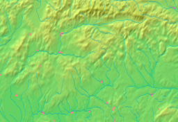
Tisovec is situated in the valley of the river Rimava, at the foots of the Muránska planina plateau. The landscape there gives the impression of a small town in the mountains. Some other towns close to it are Brezno, Hnúšťa and Revúca.
The first settlement in the area dates all the way to the Bronze Age. The first written evidence of the town comes from the year 1334 during the reign of King Charles I of Hungary as Tizolc.
The name "Tisovec" comes from the yew tree (in Slovak "tis"), which can be found in the hills around the town. Tisovec received its charter as a town at the end of the 15th century. The development of the town was halted by raids of the Ottoman Turks in the 16th and 17th centuries. The town's renaissance came in 1780, when Maria Theresia renewed its market privileges.
According to the 2001 census, the town had 4,215 inhabitants. 95.75% of inhabitants were Slovaks, 2.87% Roma, 0.78% Czechs and 0.43% Hungarians. The religious makeup was 34.59% people with no religious affiliation, 32.91% Lutherans and 29.54% Roman Catholics.
...
Wikipedia


