Tirukkoyilur
|
Tirukkovilur திருக்கோயிலூர் |
|
|---|---|
| Town Panchayat | |

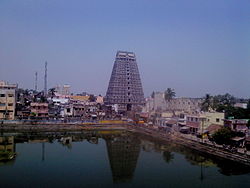
Tower of Ulagalantha Perumal Temple
|
|
| Location in Tamil Nadu, India | |
| Coordinates: 11°57′N 79°12′E / 11.95°N 79.2°ECoordinates: 11°57′N 79°12′E / 11.95°N 79.2°E | |
| Country |
|
| State | Tamil Nadu |
| District | Viluppuram district |
| Named for | Temples and Heritage |
| Government | |
| • Type | Sirappu Peruratchi |
| • Body | Chairman |
| Elevation | 73 m (240 ft) |
| Population (2011) | |
| • Total | 446,531 |
| Languages | |
| • Official | Tamil |
| Time zone | IST (UTC+5:30) |
| Vehicle registration | TN-32 |
Tirukoilur or Tirukkoyilur also called Thirukkovalur or Kovalur. is a panchayat town in Viluppuram district in the Indian state of Tamil Nadu. As the name says "koil" (means temple in Tamil language) it is famous for the temples. It is also spelled as Thirukkovilur or Thirukkoiloor situated on the banks of koil. The Veerataneshwara Shiva temple at East Thirukoilur and Ulagalantha Perumal temple, at west Tirukoyilur are located in this town. It was once a ruling city called Miladu Naadu or Malai Nadu ruled by the powerful king Malaiyamān Thirumudi Kāri of Malayaman dynasty, he is considered one of the seven greatest "Bestowers" of the last Sangam era. It was later succeeded by early chola king Killivalavan.
The Greatest Tamil king Rajaraja Cholan and his brother, The most powerful Chola Prince Aditya Karikalan was born in Keelaiyur, Tirukoilur. Raja Raja cholan was born as Arulmozhi Varman, also called as Ponniyin Selvan (son of river Kaveri),"Raasakandiyar" was the third child of Parantaka Sundara Chola. Rajaraja literally means King of Kings.
Rajaraja Chola's mother, Vaanavan Maadevi, was the daughter of Thirukkovilur king, Malayamaan Thirumudi Kaari.
Before 1000 years Tirukoilur was one of the four largest cities in Tamil Nadu like other cities named Kanchipuram, Madurai, and Thanjavur. In later period Kings like Adiyamman demolished the city. Proof in Thanjavur Big Temple. Tirukkoyilur is located at 11°57′N 79°12′E / 11.95°N 79.2°E. It has an average elevation of 73 metres (239 feet).
...
Wikipedia

