Tinn
| Tinn kommune | |||
|---|---|---|---|
| Municipality | |||

Rjukan
|
|||
|
|||
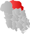
 Tinn within Telemark |
|||
| Coordinates: 60°0′33″N 8°33′34″E / 60.00917°N 8.55944°ECoordinates: 60°0′33″N 8°33′34″E / 60.00917°N 8.55944°E | |||
| Country | Norway | ||
| County | Telemark | ||
| District | Aust-Telemark | ||
| Administrative centre | Rjukan | ||
| Area | |||
| • Total | 2,045 km2 (790 sq mi) | ||
| • Land | 1,854 km2 (716 sq mi) | ||
| Area rank | 28 in Norway | ||
| Population (2006) | |||
| • Total | 6,247 | ||
| • Rank | 155 in Norway | ||
| • Density | 3/km2 (8/sq mi) | ||
| • Change (10 years) | -5.6 % | ||
| Demonym(s) | Tinndøl | ||
| Time zone | CET (UTC+1) | ||
| • Summer (DST) | CEST (UTC+2) | ||
| ISO 3166 code | NO-0826 | ||
| Official language form | Neutral | ||
| Website | www |
||
|
|
|||
| Rjukan–Notodden Industrial Heritage Site | |
|---|---|
| Name as inscribed on the World Heritage List | |

The old ammonia factory at Notodden industrial site
|
|
| Location | Norway |
| Type | Cultural |
| Criteria | ii, iv |
| Reference | 1486 |
| UNESCO region | Europe and North America |
| Inscription history | |
| Inscription | 2015 (29th Session) |
Tinn is a municipality in Telemark county, Norway. It is part of the traditional region of Øst-Telemark. The administrative centre of the municipality is the town of Rjukan.
The parish of Tin(d) was established as a municipality on 1 January 1838 (see formannskapsdistrikt). The area of Hovin was separated from the municipality of Tinn in 1860, but it was merged back into the municipality of Tinn on 1 January 1964.
Krossobanen is the oldest aerial tramway in Northern Europe. It was built in 1928 as a gift from Norsk Hydro. There is a museum and Hardangervidda National Park center at the lake Møsvatn close to Tinn.
The Old Norse form of the name was Tinnr. It is probably the old name of the Lake Tinn, the central lake in the municipality. The meaning of the name is unknown.
The coat-of-arms is from modern times. They were granted on 18 November 1994. The arms show five blue drops of water on a silver background. It was chosen to represent the five rivers in the municipality and the hydropower of Rjukan. It was designed by Halvor Holtskog.
Rjukan Falls on the Måna river allowed construction of Vemork, the largest power station in the world in 1911. The station has become a museum where one can explore the history of the energy and see exhibits about the industrial development in Norway and at Rjukan, the municipality center of Tinn.
...
Wikipedia


