Thyolo
| Thyolo | |
|---|---|
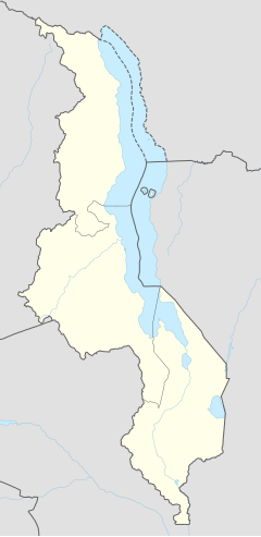
| Location in Malawi | |
| Coordinates: 16°04′S 35°08′E / 16.067°S 35.133°ECoordinates: 16°04′S 35°08′E / 16.067°S 35.133°E | |
| Country |
|
| Region | Southern Region |
| District | Thyolo District |
| Population (2008) | |
| • Total | 7 029 |
| Time zone | +2 |
| Climate | Cwa |
Thyolo is a town located in the Southern Region of Malawi. It is the administrative capital of Thyolo District. Traditional Authority Mphuka in Thyolo District is one of the 10 Traditional Authorities in Thyolo District in Malawi. There are a number of non sustainable activities that communities in the area do that are detrimental to development.
Malawi being an agricultural based economy production is dependent on natural resources whose availability and stability cannot be guaranteed in the area. Livelihoods are affected by non sustainable practices such as wanton cutting down of trees, shifting cultivation, and poor agricultural practices. The drivers of deforestation and soil erosion are interrelated with growing human population, increased demand of firewood and limited job opportunities being the main ones. The State of Environment Report of 2000 for the district identified five pressing environmental issues for the district and these included: overpopulation, encroachment in water catchment areas, poor public place sanitation, declining fish catch from natural water bodies and loss of biodiversity. One other thing that has exacerbated the social economic status of the people in this district is the introduction of tea estates a long time ago which took almost all cultivatable land away from the inhabitants leaving them only with casual labouring in the estates as an alternative for survival. The estates do little, if not nothing, for the lives of these vulnerable people.
Thyolo District is located in southern region of Malawi on the Shire highlands. It borders Mulanje to the east, Blantyre to north, and Nsanje to the south. Thyolo receives an average total rainfall of 1,125 mm (44 in) per year. The terrain in Thyolo District is transverse. The climate is dry and with savanna type of vegetation. Generally the area terrain is sloppy surrounded by mountains and rivers/streams. The soil is roam clay and some parts are rocky. TA Mphuka is about 40 kilometres from Thyolo District Council (60 km from Luchenza). The road network is relatively good but the quality of the roads is poor. This is compounded by the undulating nature of the plain that is characterised by steep descents and the rocky formation of the road surface.
There are 39 villages in TA Mphuka. These villages fall under 5 Group Village Headmen (GVH) also known as Village Development Committees (VDC) and 1 sub VDC. Average household size is 4.2. There is an approximate total population of 63,710 in 15,071 households in scattered nuclear settlements. The majority of the people are Amang’anja and partly Alomwe tribes.
...
Wikipedia

