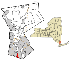
The Pelhams, New York
| Pelham | |
|---|---|
| Town | |
 Location of Pelham, New York |
|
| Coordinates: 40°54′38″N 73°48′27″W / 40.91056°N 73.80750°W | |
| Country | United States |
| State | New York |
| County | Westchester; Bronx |
| Incorporated | 1788 |
| Government | |
| • Town Supervisor | Peter DiPaola (D) (2016) |
| Area | |
| • Total | 2.2 sq mi (5.7 km2) |
| • Land | 2.2 sq mi (5.6 km2) |
| • Water | 0.04 sq mi (0.1 km2) 2.27% |
| Elevation | 63.1 ft (19.2 m) |
| Population (2010 Census) | |
| • Total | 12,396 |
| • Density | 5,600/sq mi (2,200/km2) |
| Time zone | Eastern |
| ZIP code | 10803 |
| Area code(s) | 914 |
| Website | http://www.townofpelham.com/ |
Pelham /pɛləm/ is a suburban town in Westchester County, New York and Bronx County, New York, approximately 10 miles northeast of Midtown Manhattan. As of the 2010 census, it had a population of 12,396. Historically, Pelham was composed of five villages and became known as "the Pelhams". Pelham currently contains two independently incorporated villages: the Villages of Pelham and Pelham Manor, Approximately 28 minutes away from Grand Central Terminal by the Metro-North train, Pelham is home to many New York City commuters and has an active social community for its residents.
According to the United States Census Bureau, the town has a total area of 2.4 square miles (6.2 km2). It is directly north of the New York City borough of the Bronx and borders Eastchester, New Rochelle and Mount Vernon. It also includes a small portion of the borough of the Bronx, consisting of 1,444 residents as of the 2010 census. This small area, commonly called "Bronx Manor", consists of nine residential streets: Split Rock Road, Lincoln Avenue, Ropes Avenue, McOwen Avenue, Hutchinson Avenue, Flint Avenue, Hollers Avenue, Boston Road, Pelham Bay Park West, and Good Place. This location is technically located in the Bronx, and properties are taxed accordingly at Bronx rates. Students residing in this small portion of Pelham/Bronx are zoned for Pelham/Westchester public schools, per a 1948 contract between New York City and Westchester County. This portion of the Bronx shares the same fire department and police department as the town of Pelham. Bronx Manor residents enjoy the appeal of a New York City address with a Westchester telephone area code and exchange (914-738), and ZIP code (10803). This portion of the Bronx also includes Glover Field, the playing grounds for the athletic teams of the Pelham public schools. The name "Bronx Manor" is derived from a combination of the borough of the Bronx, and the village of Pelham Manor in Westchester. Bronx Manor is served by the Bx16 route of the MTA New York City Transit bus system, the only route in the entire five-borough system to extend beyond the border of New York City. Due to geographical constraints, the Bx16 must turn left from Ropes Avenue onto Boston Road, entering Westchester County at its final point of discharge/pickup. It is also one of very few MTA routes to travel on one-way streets in a residential neighborhood (Bronx Manor). This was designed, along with a specially-constructed island in the center of Boston Post Road, in order to accommodate residents of this neighborhood which had no access to other parts of the Bronx. It is also one of the rare examples of where a U-turn is permitted on a New York City thoroughfare (to accommodate the Bx16 route), and where a right turn on red is permitted. Residents of Bronx Manor are known to be quite particular regarding their status as Bronx residents with Westchester ZIP codes and Westchester privileges, having the benefits of both city and county life. As of 2016, it has been nine years (2007) since a Bronx Manor home has been placed on the market for sale. Residents of Bronx Manor, despite their Pelham ZIP code, are eligible for political jobs for which a New York City residence is required.
...
Wikipedia
