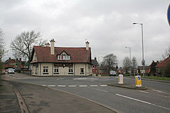
The Heath
| The Heath | |
|---|---|
 Three Tuns Public House |
|
| The Heath shown within Staffordshire | |
| Area | 1.34 km2 (0.52 sq mi) |
| Population | 6,049 (2001) |
| • Density | 4,514/km2 (11,690/sq mi) |
| OS grid reference | SK0933 |
| • London | 121 mi (195 km) SE |
| Civil parish |
|
| District | |
| Shire county | |
| Region | |
| Country | England |
| Sovereign state | United Kingdom |
| Post town | UTTOXETER |
| Postcode district | ST14 |
| Dialling code | 01889 |
| Police | Staffordshire |
| Fire | Staffordshire |
| Ambulance | West Midlands |
| EU Parliament | West Midlands |
| UK Parliament | |
The Heath is an area in Uttoxeter in Staffordshire, close to the border with Derbyshire. The Heath was once a separate settlement, but it is now considered a part of Uttoxeter, although most of Uttoxeter is now part of The Heath.
The Uttoxeter Canal previously terminated in The Heath; it was completed in 1811 and closed in 1849. The area around the canal basin is now known as The Wharf.
The Heath became a village in 1880 when the church opened.
Until the 1950s The Heath and Uttoxeter were two separate settlements. The Heath had a church, a school and several houses. Uttoxeter Heath Windmill was a feature in the area until the 1920s.
The Heath is 345 feet (105 m) above sea level and is built on a slight hill. The River Tean runs to the North of the village and the River Dove runs close by to the east. To the east of the Village there is a Dismantled Railway line which there is still evidence of.
The Heath has no specific boundaries; the most widely accepted ones are the A50 to the North, Park Street to the East, Heath Road, Holly Road and Bramshall road to the South and the West is marked by the end of the housing estate, though the boundaries to the village are not specific and often change. This covers an area of approximately 1.34 square kilometres (0.52 sq mi). The original boundaries were in a triangular shape with Heath Road to the South, Ashbourne Road to the North East and the end of Holly Road to the North West, covering an area of 27 hectares (66.72 acres).
Officially The Heath is part of the West Midlands Region however as with much with East Staffordshire it is sometimes included as part of the East Midlands such as before 1990 it was served by East Midlands Electricity and the East Midlands Gas Board.
As the name suggests The Heath is likely to mean an area of heathland to the north of Uttoxeter. The heathland today has long since gone. As the word Heath is a common place name it is often referred to as The Heath, Uttoxeter to avoid confusion. As The Heath and Uttoxeter have begun to merge the name The Heath is becoming more obsolete in non-official everyday usage.
...
Wikipedia

