The Burren
| The Burren | |
|---|---|
| Boireann | |

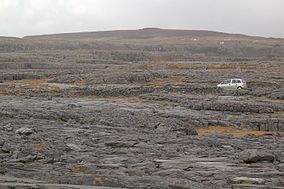
The karst landscape of the Burren
|
|
|
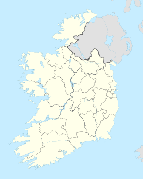
Location of the Burren National Park
|
|
| Location | County Clare, Ireland |
| Nearest city | Galway |
| Coordinates | 53°00′25″N 9°00′07″W / 53.007°N 9.002°WCoordinates: 53°00′25″N 9°00′07″W / 53.007°N 9.002°W |
The Burren (Irish: Boireann, meaning "great rock") is a region in County Clare, Ireland. It is dominated by karst landscape and measures, depending on the definition, at least 250 square kilometres. The name The Burren is most often applied to the area within the circle made by the villages of Ballyvaughan, Kinvara, Tubber, Corofin, Kilfenora and Lisdoonvarna.
The Burren National Park is one of six National Parks in Ireland and the smallest in size (15 km2).
The exact extent of the area referred to as The Burren is not clearly defined. The name is generally applied to the limestone uplands of north western Clare, but the borders vary. In the north and northwest it is bounded by Galway Bay and the Atlantic. Although mostly considered to lie in County Clare, geologically the area does extend into County Galway (see section Geology below). The Aran Islands are also a geological extension of the limestone hills that make up most of The Burren.
According to one definition, The Burren extends south to a line from the coastal resort of Lahinch to Corofin and is delimited in the east by a line roughly from Kinvara to Kilmacduagh monastery, near Gort. Note that this includes places like the town of Ennistymon and the Cliffs of Moher.
The "Burren Programme" for example defines The Burren region as extending well into the Gort plain, encompassing inter alia Coole Park and the turloughs around it. To the south it extends to Ruan and Crusheen. In the southwest it is bordered by Doolin, Lisdoonvarna, Kilfenora and Corofin.
...
Wikipedia

