Teutoburger forest
| Teutoburg Forest Teutoburger Wald |
|
|---|---|

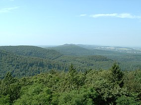
View over the Teutoburg Forest
|
|

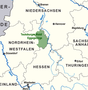
The south part of the Teutoburg Forest in North West Germany
|
|
| Location |
Germany (north-west) Lower Saxony & NRW |
| Nearest city |
Bielefeld Paderborn (to the south) Osnabrück (to the north-west) |
| Coordinates | 51°54′00″N 8°49′00″E / 51.90000°N 8.81667°ECoordinates: 51°54′00″N 8°49′00″E / 51.90000°N 8.81667°E |
| Area |
c. 4,000 km² almost all if it included officially in one of two natural parks: 1,220 km² (TERRA.vita Nature Park) 2,711 km² (Teutoburg Forest / Egge Hills Nature Park) |
The Teutoburg Forest (German: Teutoburger Wald, colloquially: Teuto) is a range of low, forested hills in the German states of Lower Saxony and North Rhine-Westphalia which was formerly believed to be the scene of Battle of the Teutoburg Forest, a decisive battle between the Germans and Romans in 9 AD. Until the 19th century the official name of the hill ridge was Osning.
The Teutoburg Forest is a peripheral section in the north of the German Central Uplands, and forms a long narrow range of hills (comprising three ridges) extending from the eastern surroundings of Paderborn in the south to the western surroundings of Osnabrück in the northwest. South of the city centre of Bielefeld, a gap called the Bielefeld Pass bisects the range into the Northern Teutoburg Forest (two thirds) and Southern Teutoburg Forest (one third). In addition, the northeastern and southwestern ridges are cut by the exits of the longitudinal valleys between the ridges.
The geologically oldest ridge is the northeastern one, which consists of limestone of the Triassic.
Most of the ridges and part of the valley are covered by deciduous forest. Parts of the valley areas are used for agriculture, especially production of cereals.
The highest elevation in the Southern Teutoburg Forest is the Velmerstot (468 m) (south of Horn-Bad Meinberg). In the Northern Teutoburg Forest the highest elevation is the Dörenberg (331 m) (north of Bad Iburg).
The river Ems has its source at the western base of the southernmost portion of the Teutoburg Forest.
...
Wikipedia
