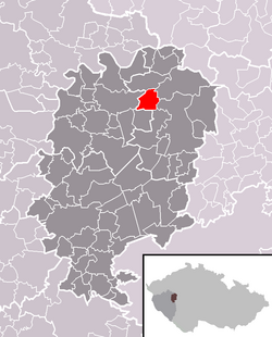
Terešov
| Terešov | |
|---|---|
| Municipality | |
 Location in Rokycany District |
|
| Location in the Czech Republic | |
| Coordinates: 49°54′10″N 13°41′49″E / 49.90278°N 13.69694°ECoordinates: 49°54′10″N 13°41′49″E / 49.90278°N 13.69694°E | |
| Country |
|
| Region | Plzeň |
| District | Rokycany |
| Area | |
| • Total | 6.7 km2 (2.6 sq mi) |
| Elevation | 408 m (1,339 ft) |
| Population (2006) | |
| • Total | 152 |
| • Density | 23/km2 (59/sq mi) |
| Postal code | 338 08 |
| Website | http://www.sweb.cz/teresov/ |
Terešov (Tereschau in German) is a village and municipality (obec) in Rokycany District in the Plzeň Region of the Czech Republic.
The municipality covers an area of 6.7 square kilometres (2.6 sq mi), and has a population of 152 (as at 28 August 2006). Terešov lies approximately 19 kilometres (12 mi) north-east of Rokycany, 29 km (18 mi) north-east of Plzeň, and 56 km (35 mi) west of Prague.
The village is firstly mentioned in 1361. In 1838 Jakob A. Popper has founded a chemical factory here.
Historically, Terešov had the oldest, as well as one of the most important Jewish communities in the Rokycany District, established already in 1623 (though some sources say even "a hundred years before that", i.e. 1520). Until the 19th Century, the Jewish Community of Terešov ("Israelitische Cultusgemeinde Tereschau") was the natural administrative and religious center for all the local small Jewish communities of the region, with a cemetery, a chevra kadisha, a rabbi, a cheder, a schochet, a mikvah and a synagogue.
The synagogue has burned down and subsequently has been pulled down by the communist authorities in 1964.
The Jewish Cemetery is still preserved till today, though in a somewhat mediocre condition; about 2 km NE from the village lies, next to the road to Bílá Skála, an area of approximately 4000 m2 with some 300 tombstones. Oldest tombstones date to 1725, newest ones into 1930's. The wall of the cemetery is in ruins, the cemetery is freely accessible.
...
Wikipedia

