Tepotzotlan
| Tepotzotlán | |
|---|---|
| Town & Municipality | |
| Coordinates: 19°42′58″N 99°13′25″W / 19.71611°N 99.22361°WCoordinates: 19°42′58″N 99°13′25″W / 19.71611°N 99.22361°W | |
| Country |
|
| State | State of Mexico |
| Founded | 1525 |
| Municipal Status | 1814 |
| Government | |
| • Municipal President | Marcos Márquez Mecado (2006–2009) |
| Area | |
| • Municipality | 208.83 km2 (80.63 sq mi) |
| Elevation (of seat) | 2,300 m (7,500 ft) |
| Population (2005) Municipality | |
| • Municipality | 67,724 |
| • Seat | 39,374 |
| Time zone | CST (UTC-6) |
| Postal code (of seat) | 54600 |
| Website | http://www.tepotzotlan.gob.mx/ |
| Former College of San Francisco Javier Camino Real de Tierra Adentro | |
|---|---|
| Name as inscribed on the World Heritage List | |
| Location | Mexico |
| Type | Cultural |
| Criteria | II, IV, |
| Reference | 1351 |
| UNESCO region | Latin America and the Caribbean |
| Coordinates | 19°42′48″N 99°13′16″W / 19.71333°N 99.22111°W |
| Inscription history | |
| Inscription | 2010 (34th Session) |
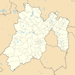
Tepotzotlán (Spanish ![]() [tepotsotla'n] ) is a city and a municipality in the Mexico state of Mexico. It is located 40 km northeast of Mexico City about a 45-minute drive along the Mexico City-Querétaro at marker number 41. In Aztec times, the area was the center of a dominion that negotiated to keep most of its independence in return with being allied with the Aztec Triple Alliance. Later, it would also be part of a “Republic of the Indians,” allowing for some autonomy under Spanish rule as well. The town became a major educational center during the colonial period when the Jesuits established the College of San Francisco Javier. The college complex that grew from its beginnings in 1580 would remain an educational center until 1914. Today this complex houses the Museo del Virreinato (Museum of the Vice Regal or Colonial Period), with one of the largest collections of art and other objects from this time period.
[tepotsotla'n] ) is a city and a municipality in the Mexico state of Mexico. It is located 40 km northeast of Mexico City about a 45-minute drive along the Mexico City-Querétaro at marker number 41. In Aztec times, the area was the center of a dominion that negotiated to keep most of its independence in return with being allied with the Aztec Triple Alliance. Later, it would also be part of a “Republic of the Indians,” allowing for some autonomy under Spanish rule as well. The town became a major educational center during the colonial period when the Jesuits established the College of San Francisco Javier. The college complex that grew from its beginnings in 1580 would remain an educational center until 1914. Today this complex houses the Museo del Virreinato (Museum of the Vice Regal or Colonial Period), with one of the largest collections of art and other objects from this time period.
The name Tepotzotlán is of Nahuatl origin and means “among humpbacks,” referring to the shape of the hills that surround this area. The oldest surviving Aztec glyph for this area is found in the Ozuna Codex, which features a humpbacked person sitting on top of a hill. This is now the symbol of the municipality. Another version of the glyph shows a humpbacked person defending a “teocalli” or sacred precinct. The municipality also has a lesser-known European-style coat-of-arms. This contains the officially adopted version of the glyph in the upper part, a representation of the Arcos del Sitio, the facade of the Church of San Francisco Javier and chimneys and a tractor representing both the agriculture and industry found here. Underneath these are written the words “Libertad, Cultura y Trabajo” (Liberty, Culture and Work).
...
Wikipedia

