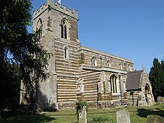
Tempsford
| Tempsford | |
|---|---|
 Church of St Peter |
|
| Tempsford shown within Bedfordshire | |
| Population | 564 (2001) 590 (2011 Census) |
| OS grid reference | TL164539 |
| Civil parish |
|
| Unitary authority | |
| Ceremonial county | |
| Region | |
| Country | England |
| Sovereign state | United Kingdom |
| Post town | SANDY |
| Postcode district | SG19 |
| Dialling code | 01767 |
| Police | Bedfordshire |
| Fire | Bedfordshire and Luton |
| Ambulance | East of England |
| EU Parliament | East of England |
| UK Parliament | |
Tempsford is a village and civil parish in the English county of Bedfordshire.
The village is split by the A1 Great North Road and is located just before the junction with the A428 at the Black Cat Roundabout. To the east of the village is the site of the former RAF Tempsford airfield.
It was served by Tempsford railway station.
In 917 Tempsford was a fortified Danish burh where, following an unsuccessful attack on Bedford, the Battle of Tempsford took place. The Danes were defeated by an English army led by King Edward the Elder.
...
Wikipedia

