A428 road
| A428 | |
|---|---|

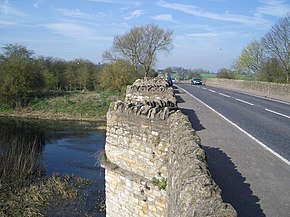
The bridge over the River Great Ouse
|
|
| Route information | |
| Length: | 82.9 mi (133.4 km) |
| Major junctions | |
| Northwest end: |
Coventry 52°24′31″N 1°29′33″W / 52.4087°N 1.4925°W |
|
|
|
| Southeast end: |
Cambridge 52°13′55″N 0°04′40″E / 52.2319°N 0.0779°E |
| Location | |
|
Primary destinations: |
Rugby Northampton Bedford Cambridge Coventry |
| Road network | |
The A428 road is a major road in central and eastern England. It connects the cities of Coventry and Cambridge by way of the county towns of Northampton and Bedford.
The road starts on the A4600 Sky Blue Way in Coventry, heading Eastbound out of the city meeting the A444 and A4082 roads before crossing the A46 Eastern Bypass and into Warwickshire. The road then passes through the village of Binley Woods before becoming more rural in nature, meeting the Fosse Way and crossing the River Avon at Bretford. 3.8 miles (6.1 km) further along, the road enters Rugby where it meets the A4071 and A426 and passes Rugby School. It then continues out of the town to the east through the suburb of Hillmorton and crosses the A5 near Daventry International Railfreight Terminal (DIRFT). It meets the M1 at its original terminus, junction 18, and bypasses the towns of Crick and West Haddon. The road passes the Althorp family estate, then enters the town of Northampton.
...
Wikipedia

