Tellico Blockhouse
|
Tellico Blockhouse Site
|
|

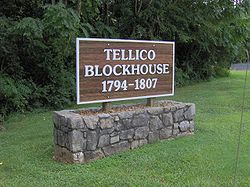
Entrance sign to the Tellico Blockhouse State Historic Area
|
|
| Location | Vonore, Tennessee, USA |
|---|---|
| Coordinates | 35°36′00″N 84°12′10″W / 35.59988°N 84.20291°WCoordinates: 35°36′00″N 84°12′10″W / 35.59988°N 84.20291°W |
| NRHP Reference # | 75001771 |
| Added to NRHP | 1975-08-11 |
The Tellico Blockhouse was an early American outpost located along the Little Tennessee River in Vonore, Monroe County, Tennessee. Completed in 1794, the blockhouse operated until 1807 with the purpose of keeping the peace between nearby Overhill Cherokee towns and early Euro-American settlers in the area in the wake of the Cherokee–American wars. The Tellico Blockhouse was the site where several treaties were negotiated in which the Cherokee were induced to cede large portions of land in Tennessee and Georgia. During this period, the blockhouse was the site of official liaisons between the United States government and the Cherokee.
The Tellico Blockhouse site is located at the junction of Nine Mile Creek and the Little Tennessee River (now Tellico Lake), just off U.S. Route 411 between Maryville and Vonore. Fort Loudoun was located just across the river to the west, but was in ruins by the time the blockhouse was built.
Although the Tellico Blockhouse originally stood on a high bluff overlooking the Little Tennessee valley, the impoundment of the river by Tellico Dam in 1979 pushed the river's present shoreline to within a few meters of the blockhouse site. The Overhill towns of Chota and Great Tellico were within a day's journey to the south. The river town of Morganton (then known as "Portville") was within walking distance, and Knoxville was just over thirty miles downstream to the north. As there were no bridges spanning the Little Tennessee until the late 19th century, blockhouse officials crossed at Niles Ferry, which was located at the modern US-411 bridge.
...
Wikipedia
