Maryville, Tennessee
| Maryville, Tennessee | |
|---|---|
| City | |

Skyline with Greenbelt Park below
|
|
| Motto: "People are the Key" | |
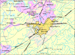
 Location of Maryville, Tennessee |
|
 U.S. Census map |
|
| Coordinates: 35°44′59″N 83°58′33″W / 35.74972°N 83.97583°WCoordinates: 35°44′59″N 83°58′33″W / 35.74972°N 83.97583°W | |
| Country | United States |
| State | Tennessee |
| County | Blount |
| Settled | 1785 |
| Incorporated | 1795 |
| Named for | Mary Grainger Blount |
| Government | |
| • Type | Council-manager |
| • City manager | Greg McClain |
| • Mayor | Tom Taylor |
| Area | |
| • Total | 16.8 sq mi (43.5 km2) |
| • Land | 16.8 sq mi (43.5 km2) |
| • Water | 0.0 sq mi (0.0 km2) |
| Elevation | 940 ft (290 m) |
| Population (2014 est.) | |
| • Total | 28,329 |
| • Density | 1,661/sq mi (641.5/km2) |
| Time zone | Eastern (EST) (UTC-5) |
| • Summer (DST) | EDT (UTC-4) |
| ZIP codes | 37801-37804 |
| Area code(s) | 865 |
| FIPS code | 47-46380 |
| GNIS feature ID | 1292868 |
| Website | www |
Maryville is a city and the county seat of Blount County, Tennessee, in the southeastern United States. Maryville's population was 27,465 at the 2010 census. It is included in the Knoxville Metropolitan Area.
Maryville has received a number of accolades for its quality of life. Maryville is a short distance from popular tourist destinations such as the Great Smoky Mountains National Park, Dollywood, Gatlinburg, and Pigeon Forge.
When the first Euro-American explorers arrived in the area, they found the Great Indian Warpath, which ran along the route where the modern US-411 has been built. It was long used by the indigenous peoples of the area. A historic Cherokee village known as "Elajay" was situated at the confluence of Ellejoy Creek (named after the village) and the Little River. Its site was near the modern Heritage High School. Ensign Henry Timberlake passed through the village in 1762 while returning from his expedition to the Overhill villages to the west. He reported that it had been abandoned.
In 1785, Revolutionary War veteran John Craig built a wooden palisade enclosing cabins at what is known as Fort Craig (or Craig's Station) at present-day Maryville. Such stations were built throughout the frontier to defend settlers against attacks from the Cherokee. "On April 11, 1793, when settlers believed Indian attacks were imminent, 280 men, women, and children gathered in small huts at John Craig's station on Nine Mile Creek."
...
Wikipedia
