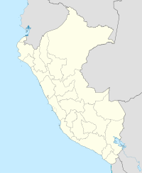
Tawqa
| Tawqa | |
|---|---|

Tawqa (on the left) and the Willkanuta valley as seen from the northwest
|
|
| Highest point | |
| Elevation | 4,039.8 m (13,254 ft) |
| Coordinates | 13°32′4″S 71°43′15″W / 13.53444°S 71.72083°WCoordinates: 13°32′4″S 71°43′15″W / 13.53444°S 71.72083°W |
| Geography | |
| Location | Peru, Cusco Region, Calca Province, Paucartambo Province |
| Parent range | Andes |
Tawqa (Quechua for heap, pile, Hispanicized spelling Tauca) is a 4,039.8-metre-high (13,254 ft) mountain in the Cusco Region in Peru. It is situated in the Calca Province, San Salvador District, and in the Paucartambo Province, Caicay District, northeast of Waypun. The Willkanuta River flows around its southern and western slopes. In the east the mountain is bordered by the Wank'amayu (Quechua for "stone river", Huancamayo). It is a right tributary of the Willkanuta River. The confluence is south of the mountain.
...
Wikipedia

