Tatshenshini-Alsek Park
| Tatshenshini-Alsek Park | |
|---|---|

Samuel Glacier
|
|
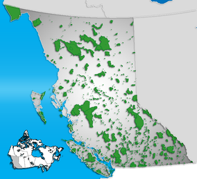
| Location of Tatshenshini-Alsek in British Columbia (this map shows only Canadian land; the blue region to the left does not distinguish between Alaska and the Pacific ocean) | |
| Location |
|
| Nearest city |
Mule Creek Airport, |
| Coordinates | 59°52′03″N 138°00′49″W / 59.86750°N 138.01361°WCoordinates: 59°52′03″N 138°00′49″W / 59.86750°N 138.01361°W |
| Area | 9,580 km2 (3,700 sq mi) |
| Established | 1993 |
| Governing body | BC Parks |
Tatshenshini-Alsek Park or Tatshenshini-Alsek Provincial Wilderness Park is a provincial park in British Columbia, Canada 9,580 km2 (3,700 sq mi). It was established in 1993 after an intensive campaign by Canadian and American conservation organizations to halt mining exploration and development in the area, and protect the area for its strong natural heritage and biodiversity values.
The park is situated in the very northwestern corner of British Columbia, bordering the American state of Alaska and the Canadian Yukon Territory. It nestles between Kluane National Park and Reserve in the Yukon and Glacier Bay & Wrangell-St. Elias National Parks and Preserves in Alaska. It is part of the Kluane-Wrangell-St. Elias-Glacier Bay-Tatshenshini-Alsek park system, and in 1994 was designated as a UNESCO World Heritage Site.
Over the centuries, numerous indigenous peoples lived in this area, including the historic Tlingit and Southern Tutchone, who built fishing villages along the rivers. The eastern edge of the park follows an ancient trade route used by the Chilkat (a Tlingit people) to barter with the Tutchone.
In the mid-19th century, the sudden breakup of a natural dam on the Alsek River caused a severe flood. The dam had been formed by the advance of a glacier across the entire Alsek River channel; the obstructed river formed a large temporary lake upstream of the blockage. A wall of water 7 m (23 ft) high and 15 m (49 ft) wide swept an entire Tutchone village into the sea at Dry Bay, killing all the inhabitants.
...
Wikipedia

