Tatamagouche
| Tatamagouche | |
|---|---|
| Village | |
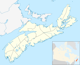
| Location of Tatamagouche in Nova Scotia | |
| Coordinates: 45°42′43″N 63°17′28″W / 45.71194°N 63.29111°W | |
| Country |
|
| Province |
|
| County | Colchester |
| Electoral Districts Federal |
Cumberland—Colchester—Musquodoboit Valley |
| Provincial | Colchester North |
| Population (2011) | |
| • Total | 2,037 |
| Time zone | AST (UTC-4) |
| • Summer (DST) | ADT (UTC-3) |
Tatamagouche /ˌtætəməˈɡʊʃ/ is a village in Colchester County, Nova Scotia, Canada.
Tatamagouche is situated on the Northumberland Strait 50 kilometres north of Truro and 50 kilometres west of Pictou. The village is located along the south side of Tatamagouche Bay at the mouths of the French and Waugh Rivers. Tatamagouche derives its name from the native Mi'kmaq term Takǔmegoochk, roughly translated as "extending across".
The first European settlers in the Tatamagouche area were the French Acadians, who settled the area in the early18th century, and Tatamagouche became a transshipment point for goods bound for Fortress of Louisbourg.
During King George's War, New England was engaged in the Siege of Louisbourg (1745) in their efforts to defeat the French. On June 15, 1745, Captain Donahew confronted Lieut. Paul Marin de la Malgue's allied force who was en route from Annapolis Royal to Louisbourg. The French convoy of two sloops and two schooners and many natives in a large number of canoes was a relief effort of French and Mi'kmaq on their way to the fortress. Donahew drove the French ashore, preventing supplies and reinforcements from reaching Louisbourg before it fell to the English. The British reported there was a "considerable slaughter" of the French and natives. The battle was significant in the downfall of Louisbourg because Marin's relief envoy was thwarted.
...
Wikipedia

