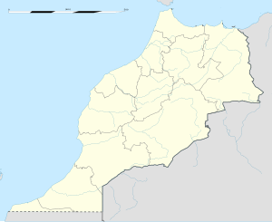
Taounate
| Taounate | |
|---|---|
| Location in Morocco | |
| Coordinates: 34°32′9″N 4°38′24″W / 34.53583°N 4.64000°W | |
| Country | Morocco |
| Region | Fès-Meknès |
| Province | Taounate Province |
| Elevation | 566 m (1,857 ft) |
| Population (2014) | |
| • Total | 37,616 |
| Time zone | WET (UTC+0) |
| • Summer (DST) | WEST (UTC+1) |
Taounate (Arabic: تاونات ; Berber: ⵜⴰⵡⵏⴰⵜ, Tawnat) is a town in the Rif Mountains of northern Morocco, and is the capital of Taounate Province. It is located at around 34°32′9″N 4°38′24″W / 34.53583°N 4.64000°WCoordinates: 34°32′9″N 4°38′24″W / 34.53583°N 4.64000°W. The town had 37,616 inhabitants as of the 2014 Moroccan census.
Taounate is located in the southern Rif Mountains, and the river Oued Sra and gorges are nearby. The town is situated on a plateau that overlooks the valley of the Oued Sra, as well as the Gargara gorges.
In 2016, it was announced that a highway development plan, estimated to be completed by 2035, will benefit the Taounate area, the highway being called the "Fès-Taounate Axis".
West of Taounate is the Al Wahda Dam on the Ouergha River, which is the largest dam in Morocco and the second largest in Africa.
...
Wikipedia

