Tanohata, Iwate
|
Tanohata 田野畑村 |
|||
|---|---|---|---|
| Village | |||

Tanohata Village Hall
|
|||
|
|||
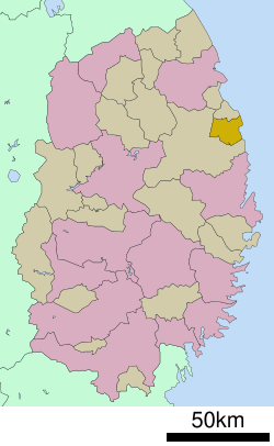
 Location of Tanohata in Iwate Prefecture |
|||
| Coordinates: 39°55′49″N 141°53′20″E / 39.93028°N 141.88889°ECoordinates: 39°55′49″N 141°53′20″E / 39.93028°N 141.88889°E | |||
| Country | Japan | ||
| Region | Tōhoku | ||
| Prefecture | Iwate | ||
| District | Shimohei | ||
| Area | |||
| • Total | 156.19 km2 (60.31 sq mi) | ||
| Population (February 2014) | |||
| • Total | 3,582 | ||
| • Density | 22.9/km2 (59/sq mi) | ||
| Time zone | Japan Standard Time (UTC+9) | ||
| City symbols | |||
| • Tree | Paulownia tomentosa | ||
| • Flower | Rhododendron subg. Hymenanthes | ||
| • Bird | Copper pheasant | ||
| Phone number | 0194-34-2111 | ||
| Address | 143-1 Tanohata, Tanohata-mura, Shimohei-gun, Iwate-ken 028-8407 | ||
| Website | Official website | ||
Tanohata (田野畑村 Tanohata-mura?) is a village located in Shimohei District, Iwate, Japan. As of February 2014, the town had an estimated population of 3,582 and a population density of 22.9 persons per km2. The total area was 156.19 km2.
Tanohata is a coastal mountainous community situated on the Sanriku Coast along the Pacific Ocean. Parts of the village are within the borders of the Sanriku Fukkō National Park.
The area of present-day Tanohata was part of ancient Mutsu Province, dominated by the Nambu clan during the Edo period, who ruled Hachinohe Domain under the Tokugawa shogunate. The village of Tanohata was created within Kitahei District on April 1, 1889. Kitahei, Nakahei and Higashihei Districts were all merged into Minamihei District on March 29, 1896. The area is prone to tsunami, with damage recorded as early as the 869 Sanriku earthquake. The 1611 Sanriku earthquake also caused major damage and the 1896 Sanriku earthquake destroyed most of the village, as did the 1933 Sanriku earthquake.
...
Wikipedia


