Tama-ku, Kawasaki
|
Tama 多摩区 |
||
|---|---|---|
| Ward | ||
| Tama Ward | ||

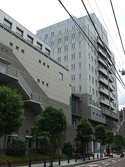
Tama Ward Office
|
||
|
||
 Location of Tama in Kanagawa Prefecture |
||
| Coordinates: 35°37′11″N 139°33′43″E / 35.61972°N 139.56194°ECoordinates: 35°37′11″N 139°33′43″E / 35.61972°N 139.56194°E | ||
| Country | Japan | |
| Region | Kantō | |
| Prefecture | Kanagawa | |
| City | Kawasaki | |
| Established | April 1, 1972 | |
| Area | ||
| • Total | 20.49 km2 (7.91 sq mi) | |
| Population (March 2010) | ||
| • Total | 211,221 | |
| • Density | 10,310/km2 (26,700/sq mi) | |
| Time zone | Japan Standard Time (UTC+9) | |
| - Tree | Flowering Dogwood, Nashi Pear | |
| - Flower | Viola, Peach | |
| Address | 1775-1 Noborito, Tama-ku Kawasaki-shi, Kanagawa-ken 214-8570 |
|
| Website | www |
|
Tama-ku (多摩区?) is one of the eight wards of the city of Kawasaki in Kanagawa Prefecture, Japan. As of 2010, the ward has an estimated population of 211,221 and a population density of 10,310 persons per km². The total area is 20.49 km².
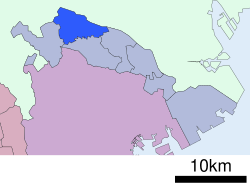
Tama Ward is located in eastern Kanagawa Prefecture, in the far northeastern corner of the city of Kawasaki, bordering on Tokyo. It is bordered to the north by the Tama River
The area around present-day Tama Ward has been inhabited for thousands of years. Archaeologists have found kofun along the banks of the Tama River and at other locations in the Ward. Under the Nara period Ritsuryō system, it was divided between Tachibana District, Tama District and Tsutsuki District in Musashi Province. By the Heian period it was part of a shōen controlled by the Inage clan. By the Kamakura period, it was controlled by their descendants, the Ozawa clan, and in the Muromachi period by the Terao clan. During the Sengoku period, the area was a contested territory between the Uesugi clan and the Late Hōjō clan from Odawara, who emerged in control by 1530. The area was devastated by flooding when the Tama River shifted course to the north in 1590. After the defeat of the Hōjō at the Battle of Odawara, the territory came under the control of Tokugawa Ieyasu. It was administered as tenryō territory controlled directly by the Tokugawa shogunate, but administered through various hatamoto. From 1725, the 52 villages of the area were a designated zone for Falconry by the Tokugawa shoguns, but suffered from repeated natural disasters: an earthquake in 1782, floods in 1786, famine in 1787, floods in 1790, 1791 and 1809 and earthquake in 1855.
...
Wikipedia


