Taibe, Galilee
|
Taibe טַּיִּבָּה لطيبة |
|
|---|---|

Taibe, 2010
|
|
| Coordinates: 32°36′N 35°26′E / 32.600°N 35.433°ECoordinates: 32°36′N 35°26′E / 32.600°N 35.433°E | |
| Grid position | 192/223 PAL |
| District | Northern |
| Council | Gilboa |
| Population (2015) | 1,751 |
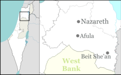
Taibe (Arabic: الطيبة; Hebrew: טַּיִּבָּה), meaning "The goodly", is a Muslim Arab village in northeastern Israel. Located in the Jezreel Valley, it falls under the jurisdiction of Gilboa Regional Council. In 2015 it had a population of 1,751.
It has been proposed that Taibe was Tubi, listed among the places paying tribute to Thutmose III. Remains from the Hellenistic, Roman, Byzantine, Crusader, and Mamluk periods have been found.
During the Crusader period there was a castle here called (Le) Forbelet (in medieval Arabic: 'Afrabala). It was probably Hospitaller and dependent on nearby Belvoir. In July 1182 the castle was the background of the pitched large-scale Battle of Forbelet between Baldwin IV and Saladin. The castle was sacked by Saladin in 1183, and occupied by the Muslims besieging Belvoir in 1187-88. Parts of the castle keep's basement still survive, as do other installations from the Crusader Period. Recent excavations indicate that new buildings were constructed alongside the partially destroyed Crusader castle in Mamluk and Ottoman times.
Taibe was incorporated into the Ottoman Empire in 1517 with all of Palestine, and in 1596 it appeared in the tax registers under the name of Tayyibat al-Ism as being in the Nahiya of Shafa of the Liwa of Lajjun, apparently sharing this name with another village farther south-west. It had a population of 13 Muslim households and paid taxes on wheat, barley, summercrops, and goats or beehives.Pierre Jacotin named the village Taibeh on his map from 1799.
...
Wikipedia

